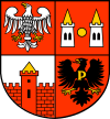
Gmina Płońsk
Gmina Płońsk is a rural gmina (administrative district) in Płońsk County, Masovian Voivodeship, in east-central Poland. Its seat is the town of Płońsk, although the town is not part of the territory of the gmina.
Gmina Płońsk Płońsk Commune | |
|---|---|
 Coat of arms | |
| Coordinates (Płońsk): 52°38′N 20°23′E | |
| Country | |
| Voivodeship | Masovian |
| County | Płońsk |
| Seat | Płońsk |
| Area | |
| • Total | 127.3 km2 (49.2 sq mi) |
| Population (2013[1]) | |
| • Total | 7,669 |
| • Density | 60/km2 (160/sq mi) |
The gmina covers an area of 127.3 square kilometres (49.2 sq mi), and as of 2006 its total population is 7,135 (7,669 in 2013).
Villages
Gmina Płońsk contains the villages and settlements of Arcelin, Bogusławice, Bońki, Brody, Cempkowo, Cholewy, Cieciórki, Ćwiklin, Ćwiklinek, Dalanówko, Ilinko, Ilino, Jeżewo, Kluczewo, Kownaty, Koziminy-Stachowo, Krępica, Lisewo, Michalinek, Michowo, Młyńsk, Nowe Koziminy, Pilitowo, Poczernin, Pruszyn, Raźniewo, Siedlin, Skarzyn, Skrzynki, Słoszewo, Słoszewo-Kolonia, Stare Koziminy, Strachówko, Strachowo, Strubiny, Szeromin, Szerominek, Szpondowo, Szymaki, Woźniki, Wroninko and Zawady.
Neighbouring gminas
Gmina Płońsk is bordered by the town of Płońsk and by the gminas of Baboszewo, Dzierzążnia, Joniec, Naruszewo, Sochocin and Załuski.
