Gmina Iłowa
Gmina Iłowa is an urban-rural gmina (administrative district) in Żagań County, Lubusz Voivodeship, in western Poland. Its seat is the town of Iłowa, which lies approximately 15 kilometres (9 mi) south-west of Żagań and 53 km (33 mi) south-west of Zielona Góra.
Gmina Iłowa Iłowa Commune | |
|---|---|
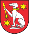
 Coat of arms | |
| Coordinates (Iłowa): 51°30′7″N 15°12′21″E | |
| Country | |
| Voivodeship | Lubusz |
| County | Żagań |
| Seat | Iłowa |
| Area | |
| • Total | 153.05 km2 (59.09 sq mi) |
| Population (2019-06-30[1]) | |
| • Total | 6,881 |
| • Density | 45/km2 (120/sq mi) |
| • Urban | 3,892 |
| • Rural | 2,989 |
| Website | http://www.ilowa.pl |
The gmina covers an area of 153.05 square kilometres (59.1 sq mi), and as of 2019 its total population is 6,881.
Villages
Apart from the town of Iłowa, Gmina Iłowa contains the villages and settlements of Borowe, Czerna, Czyżówek, Jankowa Żagańska, Klików, Konin Żagański, Kowalice, Nowoszów, Szczepanów, Wilkowisko and Żaganiec.
Neighbouring gminas
Gmina Iłowa is bordered by the towns of Gozdnica and Żagań, and by the gminas of Osiecznica, Węgliniec, Wymiarki, Żagań and Żary.
Twin towns – sister cities
Gmina Iłowa is twinned with:[2]


gollark: Death Star flag I found in my photo library.
gollark: Klein flag!
gollark: Or elliptical.
gollark: Why not make the flag circular and annoy everyone at once?
gollark: What might work is dividing the central circle bit into some nice contrasting colors.
References
- "Population. Size and structure and vital statistics in Poland by territorial divison in 2019. As of 30th June". stat.gov.pl. Statistics Poland. 2019-10-15. Retrieved 2020-04-05.
- "Gminy partnerskie". ilowa.pl (in Polish). Gmina Iłowa. Retrieved 2020-04-05.
This article is issued from Wikipedia. The text is licensed under Creative Commons - Attribution - Sharealike. Additional terms may apply for the media files.
