Gmina Abramów
Gmina Abramów is a rural gmina (administrative district) in Lubartów County, Lublin Voivodeship, in eastern Poland. Its seat is the village of Abramów, which lies approximately 20 kilometres (12 mi) west of Lubartów and 29 km (18 mi) north-west of the regional capital Lublin.
Gmina Abramów Abramów Commune | |
|---|---|
 Flag  Coat of arms | |
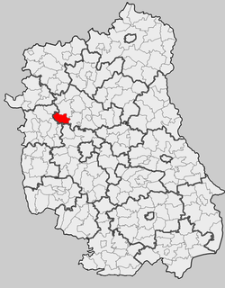 Location within the county and voivodeship | |
| Coordinates (Abramów): 51°27′20″N 22°19′0″E | |
| Country | |
| Voivodeship | Lublin |
| County | Lubartów |
| Seat | Abramów |
| Area | |
| • Total | 84.54 km2 (32.64 sq mi) |
| Population (2014[1]) | |
| • Total | 4,182 |
| • Density | 49/km2 (130/sq mi) |
| Website | http://www.abramow.pl/ [2] |
The gmina covers an area of 84.54 square kilometres (32.6 sq mi), and as of 2006 its total population is 4,309 (4,182 in 2014).
Neighbouring gminas
Gmina Abramów is bordered by the gminas of Baranów, Garbów, Kamionka, Kurów, Markuszów, Michów, and Żyrzyn.
Villages
The gmina contains the villages of Abramów, Ciotcza, Dębiny, Glinnik, Izabelmont, Marcinów, Michałówka, Sosnówka, Wielkie, Wielkolas, and Wolica.
gollark: Interesting.
gollark: Just post here then.
gollark: It remains possible to transfer points.
gollark: It isn't over yet.
gollark: <@319753218592866315> I challenge you to give me *3/4* of your points.
References
- "Demographic Yearbook of Poland 2014". Archived from the original on 2016-02-20. Retrieved 2016-12-29.
- "Biuletyn Informacji Publicznej - Urząd Gminy Abramów". Biuletyn Informacji Publicznej. Urząd Gminy Abramów. Retrieved 23 June 2016.
External links
| Seat | | |
|---|---|---|
| Other villages | ||
| Seat |
|  |
|---|---|---|
| Urban-rural gminas | ||
| Rural gminas | ||
| Other features | ||
This article is issued from Wikipedia. The text is licensed under Creative Commons - Attribution - Sharealike. Additional terms may apply for the media files.