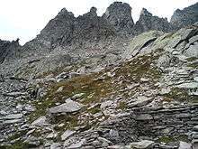
Glockenkarkopf
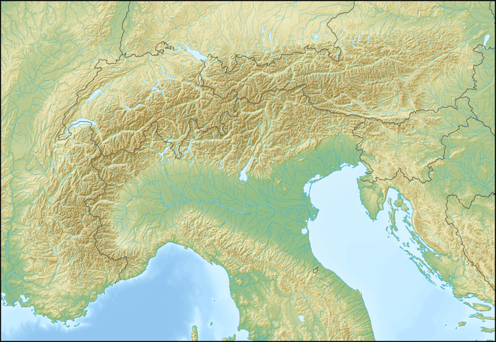
The Glockenkarkopf (also known as Klockerkarkopf, Italian Vetta d'Italia) is a mountain of 2,911 metres (9,551 ft) in the Zillertal Alps on the border between the Austrian state Salzburg and the Italian province of South Tyrol.
| Glockenkarkopf | |
|---|---|
 Glockenkarkopf Location in the Alps | |
| Highest point | |
| Elevation | 2,911 m (9,551 ft) |
| Isolation | 0.3 km (0.19 mi) |
| Coordinates | 47°05′28″N 12°10′50″E |
| Geography | |
| Location | Salzburg (state), Austria, South Tyrol, Italy |
| Parent range | Zillertal Alps |
| Climbing | |
| First ascent | 1895 by Franz Hofer andFritz Kögl[1] |
Location
The ridgeline of Glockenkarkopf forms the international border extending between two mountain passes, Krimmler Tauern in the west and Birnlücke (Forcella del Picco) in the east. Nearby summits include Tauernkopf (2874 m above mean sea level) to the west, and to the southwest the higher Pfaffenschneidkopf (2918 m), from which the Pfaffenschneid slopes (strikes) southward. This slope is crossed by the Lausitz path at the Teufelsstiege (Devil's Stair).
Political history and toponymy
In 1896 the mountain, then belonging to Austria-Hungary, was mentioned in the journal of the Österreichischer Alpenverein. The summit was reached for the first time in 1895 by Franz Hofer and Fritz Kögl.[1] On 16 July 1904 the Italian nationalist, irredentist, and later fascist Ettore Tolomei climbed the mountain, proclaimed himself the first to reach its summit, asserted that it was the northernmost point of the Adriatic Sea's drainage basin and thus belonged to Italy, and named it "Vetta d'Italia" ("Peak of Italy"). However, the Treaty of Saint-Germain-en-Laye (1919) defines the northernmost point of Italy as the summit not of Glockenkarkopf, but of nearby Western Zwillingsköpfl (2841 m), which is slightly farther north and is in fact the northernmost point of the Adriatic Sea's drainage basin.
Tolomei's name is used in Italian maps from 1905 onward. Austrian nobleman and political theorist Erik von Kuehnelt-Leddihn wrote that United States president Woodrow Wilson was poorly knowledgeable about European geography and history, and that the name "Vetta d'Italia" convinced him of the legitimacy of Italy's claim to the region.[2]
Besides the name "Vetta d'Italia", which is widely rejected by the German-speaking population of South Tyrol, local researchers on the toponymy of village names argue that "Klockerkarkopf" (not Glockenkarkopf) is the older and correct name, being derived from the name "Klockeralm".[3][4][5]
Literature
- Klier, Heinrich; Klier, Henriette; Klier, Walter (1990). Alpenvereinsführer Zillertaler Alpen. Munich: München Rother. ISBN 3-7633-1201-3.
References
- Fabio Cammelli, Werner Beikircher (2002). Alpi Aurine: Brènnero, Gran Pilastro, Vetta d'Italia. Touring Editore. ISBN 978-88-365-2603-1., page 318
- Kuehnelt-Leddihn, Erik von (1990). Leftism revisited: from de Sade and Marx to Hitler and Pol Pot. Washington, D.C: Regnery Gateway. ISBN 0-89526-537-0., page 205
- "Autonome Provinz Bozen - Südtirol | Hochbau und technischer Dienst". Retrieved 2011-10-26.
- "www.provinz.bz.it". Retrieved 2011-10-26.
- "Gletschertour Klockerkarkopf und Dreiherrenspitze - Alpenverein Südtirol - Bozen - Südtirol". Retrieved 2011-10-26.
External links
![]()
| Authority control |
|
|---|