Giewont
Giewont (Polish pronunciation: [ˈɡʲɛvɔnt] (![]()
| Giewont | |
|---|---|
 | |
| Highest point | |
| Elevation | 1,895 m (6,217 ft) |
| Coordinates | 49°15′02″N 19°56′02″E |
| Geography | |
| Location | Poland |
| Parent range | Western Tatras |
| Climbing | |
| First ascent | 1830 |
| Easiest route | South |
It comprises three peaks (all m/metres in AMSL):
- Small Giewont (Polish Mały Giewont, 1,728 m)
- Great Giewont (Wielki Giewont, 1,895 m)
- Long Giewont (Długi Giewont, 1,867 m).
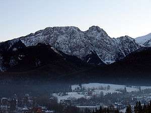
There is a mountain pass located between Great and Long Giewont, known as Szczerba (1,823 m). It is located between the valleys (doliny) of Kondratowa, Małej Łąki and Strążyska. Long Giewont and Great Giewont are situated at a higher altitude than the nearby town of Zakopane, making them clearly visible from that city.
On Great Giewont, there is a 15 m steel cross (erected in 1901) – the site of religious pilgrimages. The area is notorious for its hazardous nature during thunderstorms. On 22 August 2019 four people were killed and hundreds were injured during an unexpected 2019 Tatras' thunderstorm. Most of the victims were on Giewont, where lightning struck the metal cross atop the mountain as well as a metal chain near the summit, according to local media. The four dead in Poland included two children, a spokeswoman for the Polish air ambulance service, Kinga Czerwinska, told the news broadcaster TVN24. One person died in Slovakia.
“There were a few deaths in different parts of the Tatra mountains,” Jan Krzysztof, a Polish mountain rescue service chief told Poland’s PAP news agency.
“More than 100 people are injured,” Poland’s prime minister, Mateusz Morawiecki, said after arriving in the nearby mountain resort town of Zakopane. He said some were in a very serious condition, suffering from burns or head injuries.
Rescuers believe many hikers were present when lightning struck the cross on Giewont’s summit. They had set out to climb Poland’s highest mountains when the skies were clear earlier in the day. It was the biggest disaster in Polish Mountains since 1937.
Geologically, Giewont is composed of dolomite and limestone caves, as well as gneiss and granite in the southern section.
The first recorded ascent to Giewont's summit was undertaken in 1830 by mountaineers Franciszek Herbich and Aleksander Zawadzki. The first winter ascent of Giewont occurred in 1904 by a group of five mountaineers led by Mariusz Zaruski. Nowadays the climbing of Giewont is strictly banned. On the other hand, hiking on the hiking trails is allowed and the access (except the winter) is not difficult hence Giewont is a very popular destination among amblers and Sunday tourists. In the summer up to a few thousand tourists a day ascend the top of the mountain.
Giewont lies in the area of the Polish Tatra National Park (Tatrzański Park Narodowy). In Polish folklore it is associated with a legend about sleeping knights, who will awake when Poland is in danger. The profile of the mountains is similar to a lying knight, wherein the Long Giewont is the knight's torso, and the Great Giewont is the knight's face as viewed from the side (the three 'peaks' being the chin, the nose, and the eyebrow). The image of Giewont as viewed from the north (see below) makes the profile easy to discern.
 View of Giewont by Aleksander Kotsis (after 1870), National Museum in Warsaw
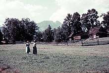
 Giewont (1938)
 View from the East
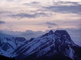
 Great Giewont - view from the West
- Giewont (massif) – view from the South
External links
| Wikimedia Commons has media related to Giewont. |
- Zakopane - Giewont webcam
- "Giewont". SummitPost.org.
- Giewont webcam - click "Day at a Glance" if night.