Ghanauli
Ghanauli village is situated near Rupnagar in Rupnagar district in the state of Punjab in India.
Ghanauli | |
|---|---|
Town | |
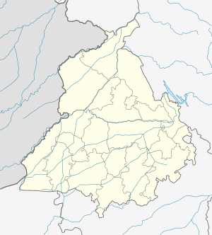 Ghanauli Location in Punjab, India  Ghanauli Ghanauli (India) | |
| Coordinates: 31.025306°N 76.589634°E | |
| Country | India |
| State | Punjab |
| District | Rupnagar |
| Government | |
| • Type | Local Government |
| • Body | State Government of Punjab, Government of India |
| Elevation | 277 m (909 ft) |
| Population (2011) | |
| • Total | 4,894[1] |
| Languages | |
| • Principal | Punjabi, Hindi |
| Time zone | UTC+5:30 (IST) |
| PIN | 140113 |
| Telephone code | 01881 |
| Vehicle registration | PB- 12 |
Location
Ghanauli lies on the bank of river Sutlej near Rupnagar. The village basically located on National Highway 205 (Earlier NH 21) section between Rupnagar and Kiratpur Sahib in Punjab.
Rupnagar, Baddi ,Kurali ,Kiratpur Sahib are the nearby Cities to Ghanauli. Himachal Pradesh State line is only 4.5 Kiometers from Ghanauli. This Place is in the border of the Rupnagar district and Solan district. Solan District Nalagarh is East towards this place.
gollark: ↓ you
gollark: So it's just 60 Hz^-1, or (60 Hz)^-1.
gollark: Hz^-1 is dimensionally seconds.
gollark: No.
gollark: It definitely isn't, no.
This article is issued from Wikipedia. The text is licensed under Creative Commons - Attribution - Sharealike. Additional terms may apply for the media files.