German Township, Auglaize County, Ohio
German Township is one of the fourteen townships of Auglaize County, Ohio, United States. The 2010 census found 3,748 people in the township,[3] 770 of whom lived in the unincorporated portions of the township.
German Township, Auglaize County, Ohio | |
|---|---|
 The Julius Boesel House, a landmark in the township | |
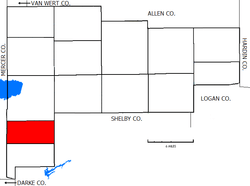 Location of German Township in Auglaize County | |
| Coordinates: 40°26′25″N 84°23′0″W | |
| Country | United States |
| State | Ohio |
| County | Auglaize |
| Area | |
| • Total | 18.5 sq mi (47.8 km2) |
| • Land | 18.5 sq mi (47.8 km2) |
| • Water | 0.0 sq mi (0.0 km2) |
| Elevation | 935 ft (285 m) |
| Population (2010) | |
| • Total | 3,748 |
| • Density | 203/sq mi (78.4/km2) |
| Time zone | UTC-5 (Eastern (EST)) |
| • Summer (DST) | UTC-4 (EDT) |
| FIPS code | 39-29848[2] |
| GNIS feature ID | 1085764[1] |
Geography
Located in the southwestern part of the county, it borders the following townships:
- Saint Marys Township - north
- Van Buren Township, Shelby County - east
- McLean Township, Shelby County - southeast corner
- Jackson Township - south
- Marion Township, Mercer County - southwest
- Franklin Township, Mercer County - northwest
The village of New Bremen is located in eastern German Township, and the unincorporated community of Lock Two lies in the northeastern part of the township.
According to the U.S. Census Bureau, German Township has an area of 18.5 square miles (47.8 km2).[3]
Name and history
It is one of five German Townships statewide.[4]
Formed while still part of Mercer County, the township originally included Jackson Township until separation in 1858.[5] One house in the township, the Julius Boesel House just north of New Bremen, is listed on the National Register of Historic Places.[6]
Government
The township is governed by a three-member board of trustees, who are elected in November of odd-numbered years to a four-year term beginning on the following January 1. Two are elected in the year after the presidential election and one is elected in the year before it. There is also an elected township fiscal officer,[7] who serves a four-year term beginning on April 1 of the year after the election, which is held in November of the year before the presidential election. Vacancies in the fiscal officership or on the board of trustees are filled by the remaining trustees.
Public services
The majority of the township is in the New Bremen School District with southwestern portions being located the Marion Local School District.
The majority of the township is served by the New Bremen (45869) post office, while the southeastern section of the township is served by the Minster (45865) post office.
References
- "US Board on Geographic Names". United States Geological Survey. 2007-10-25. Retrieved 2008-01-31.
- "U.S. Census website". United States Census Bureau. Retrieved 2008-01-31.
- "Geographic Identifiers: 2010 Demographic Profile Data (G001): German township, Auglaize County, Ohio". U.S. Census Bureau, American Factfinder. Archived from the original on February 12, 2020. Retrieved July 10, 2013.
- "Detailed map of Ohio" (PDF). United States Census Bureau. 2000. Retrieved 2007-02-16.
- Auglaize County, Ohio Atlas and History Archived June 11, 2011, at the Wayback Machine, Piqua: Magee Brother Publishing, 1917. Accessed 05 July 2007. Page 103.
- Owen, Lorrie K., ed. Dictionary of Ohio Historic Places. Vol. 1. St. Clair Shores: Somerset, 1999, 50.
- §503.24, §505.01, and §507.01 of the Ohio Revised Code. Accessed 4/30/2009.
External links
Municipalities and communities of Auglaize County, Ohio, United States | ||
|---|---|---|
| Cities |  Map of Ohio highlighting Auglaize County | |
| Villages | ||
| Townships | ||
| CDPs | ||
| Unincorporated communities | ||
| Ghost towns |
| |
| Footnotes | ‡This populated place also has portions in an adjacent county or counties | |