Gerald, Alabama
Gerald was an unincorporated community in Dale County until 1965, when the area was incorporated into the town limits of the newly formed Level Plains, Alabama, United States.
Gerald, Alabama | |
|---|---|
 Gerald  Gerald | |
| Coordinates: 31°19′26″N 85°45′26″W | |
| Country | United States |
| State | Alabama |
| County | Dale |
| Elevation | 180 ft (50 m) |
| Time zone | UTC-6 (Central (CST)) |
| • Summer (DST) | UTC-5 (CDT) |
| Area code(s) | 334 |
| GNIS feature ID | 156402[1] |
History
A post office operated under the name Gerald from 1898 to 1901.[2] Gerald was a train whistle-stop on the Alabama Midland Railway running from Newton to Enterprise.[3]
gollark: There are also different WiFi standards for packing higher data rates into whatever frequency range, some of which work, I think, by using several streams at different frequencies combined.
gollark: 2.4GHz and 5GHz are different, er, frequencies, though stuff doesn't run at exactly those frequencies but generally around them.
gollark: That's not really quite accurate.
gollark: You mean 5GHz WiFi or 5G the unneceesary mobile standard?
gollark: RFTools has a builder block thing which can copy areas if you feed in the items, which makes the difficult bit just autoproducing all the items involved, which other mods can do okayishly.
References
- "Gerald". Geographic Names Information System. United States Geological Survey.
- "Dale County". Jim Forte Postal History. Archived from the original on 12 January 2016. Retrieved 28 December 2015.
- Alabama Midland Railway and Wiregrass Central Railroad.
Municipalities and communities of Dale County, Alabama, United States | ||
|---|---|---|
| Cities | 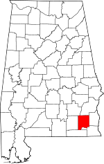 Map of Alabama highlighting Dale County | |
| Towns | ||
| CDP | ||
| Unincorporated communities | ||
| Footnotes | ‡This populated place also has portions in an adjacent county or counties | |
This article is issued from Wikipedia. The text is licensed under Creative Commons - Attribution - Sharealike. Additional terms may apply for the media files.