Clopton, Alabama
Clopton is an unincorporated community and census-designated place (CDP) in Dale County, Alabama, United States. Clopton is located on Alabama State Route 105, 10.9 miles (17.5 km) west-northwest of Abbeville.[2]
Clopton, Alabama | |
|---|---|
 Clopton  Clopton | |
| Coordinates: 31°36′31″N 85°25′48″W | |
| Country | United States |
| State | Alabama |
| County | Dale |
| Elevation | 505 ft (154 m) |
| Time zone | UTC-6 (Central (CST)) |
| • Summer (DST) | UTC-5 (CDT) |
| ZIP code | 36317 |
| Area code(s) | 334 |
| GNIS feature ID | 116275[1] |
History
Clopton had a post office from August 22, 1853, to November 19, 2011; it still has its own ZIP code, 36317.[3][4]
During the Spanish flu epidemic, in 1919 a local physician reported that he had treated more than four-hundred cases in the community.[5]
Demographics
| Historical population | |||
|---|---|---|---|
| Census | Pop. | %± | |
| 1880 | 142 | — | |
| U.S. Decennial Census[6] | |||
Clopton was listed as an unincorporated community in the 1880 U.S. Census with a population of 142.
Notable people
- Henry B. Steagall, U.S. Representative from 1915 to 1943. Co-sponsored the Glass-Steagall Act and Wagner-Steagall National Housing Act.
- Hannah McKay, a fictional character portrayed by Yvonne Strahovski who is romantically involved with Dexter Morgan in Dexter.
gollark: Idea: Macron is to become the sum of all cosines simultaneously.
gollark: A tensor is something which transforms like a tensor.
gollark: They also allegate.
gollark: Alligators alligate at 73MHz at certain GTech™ sites.
gollark: You're quite like```[0.03840074 0.02975524 0.02863874 0.02446118 0.02198991 0.0216628 0.01939501 0.01914387 0.01619873 0.0159581 0.01504209 0.0148157 0.01372842 0.01348538 0.01299309 0.01272586 0.01180078 0.01157911 0.01108706 0.01090345 0.01082172 0.01023815 0.01019116 0.00952584 0.00925469 0.00892519 0.00870943 0.00858689 0.00838231 0.00820057 0.00795165 0.0078358 0.00776038 0.00750175 0.00745906 0.00719042 0.00704065 0.00691189 0.00680147 0.00676946 0.00673968 0.00665735 0.00653111 0.00640008 0.00631931 0.00620605 0.00611003 0.0059721 0.00588376 0.00576058 0.00570423 0.00564807 0.00562632 0.0055737 0.0054597 0.00540872 0.00535288 0.00524546 0.00520739 0.00504298 0.00499241 0.0049367 0.00492335 0.004869 0.00477718 0.00472859 0.00464163 0.00462261 0.00454305 0.0044588 0.00445091 0.00436952 0.00431991 0.00424099 0.00421286 0.00414987 0.0041378 0.00410382 0.00401213 0.00395153 0.00388661 0.00387957 0.00385992 0.0038192 0.00373665 0.0037066 0.00367598 0.00362159 0.00360851 0.00353362 0.00348063 0.00346549 0.00337007 0.00333954 0.00330755 0.00326649 0.00319944 0.00315906 0.00310103 0.00307263 0.00303511 0.00301894 0.00300944 0.00296566 0.00293579 0.00290691 0.00284097 0.00282599 0.00280492 0.00278099 0.00269841 0.00265956 0.00261216 0.00258167 0.00256163 0.00252229 0.00248712 0.00243954 0.00236763 0.00233683 0.002314 0.00230179 0.00226548 0.00224578 0.00220935 0.00216469 0.00215114 0.00214052 0.00207293 0.00204525 0.00202677 0.00199634]```
References
- "Clopton". Geographic Names Information System. United States Geological Survey.
- General Highway Map: Dale County, Alabama (PDF) (Map). Alabama Department of Transportation. 2010. Archived from the original (PDF) on February 21, 2014. Retrieved February 11, 2013.
- United States Postal Service (2012). "USPS - Look Up a ZIP Code". Retrieved 2012-02-15.
- "Postmaster Finder - Post Offices by ZIP Code". United States Postal Service. Retrieved February 11, 2013.
- "400 Cases of Influenza in Clopton Community". Abbeville Herald. 4 (7). Abbeville, Alabama: Abbeville Printing Co. 16 January 1919. p. 1 – via Newspapers.com.
- "U.S. Decennial Census". Census.gov. Archived from the original on May 12, 2015. Retrieved June 6, 2013.
Municipalities and communities of Dale County, Alabama, United States | ||
|---|---|---|
| Cities | 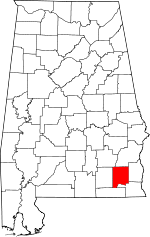 Map of Alabama highlighting Dale County | |
| Towns | ||
| CDP | ||
| Unincorporated communities | ||
| Footnotes | ‡This populated place also has portions in an adjacent county or counties | |
This article is issued from Wikipedia. The text is licensed under Creative Commons - Attribution - Sharealike. Additional terms may apply for the media files.