Gennep
Gennep (![]()
Gennep | |
|---|---|
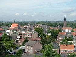 View over Gennep | |
 Flag Coat of arms | |
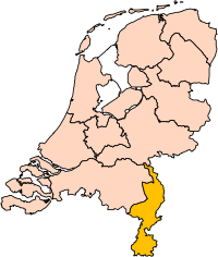
.svg.png) Location in Limburg | |
| Coordinates: 51°42′N 5°58′E | |
| Country | Netherlands |
| Province | Limburg |
| Government | |
| • Body | Municipal council |
| • Mayor | Peter de Koning (VVD) |
| Area | |
| • Total | 50.42 km2 (19.47 sq mi) |
| • Land | 47.71 km2 (18.42 sq mi) |
| • Water | 2.71 km2 (1.05 sq mi) |
| Elevation | 13 m (43 ft) |
| Population (January 2019)[4] | |
| • Total | 17,071 |
| • Density | 358/km2 (930/sq mi) |
| Demonym(s) | Gennepenaar, Genneper |
| Time zone | UTC+1 (CET) |
| • Summer (DST) | UTC+2 (CEST) |
| Postcode | 6590–6599 |
| Area code | 0485 |
| Website | www |
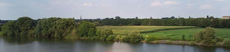
The Niers river flows into the Meuse in Gennep.
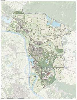
Population centres
- Aaldonk
- Dam
- De Looi
- Diekendaal
- Gennep
- Heijen
- Hekkens
- Milsbeek
- Ottersum
- Smele
- Ven-Zelderheide
- Zelder
The city of Gennep
Gennep was the title of a comital family, known descendants of which are the famous Saint Norbert of Gennep and William of Gennep, Archbishop-Elector of Cologne.
Gennep probably received city rights in 1371. However, it remains unclear whether these city rights have really been assigned to Gennep, as the supposed documents burned during a fire in the townhall of Gennep at the end of the 16th century. Gennep lies about 18 kilometres (11 miles) southeast of Nijmegen.
In 2001, Gennep had 8306 inhabitants. The built-up area of the town was 2.11 square kilometres (0.81 sq mi), and contained 3124 residences.[5]
Notable people
- Marcel van Grunsven (1896 in Gennep - 1969) Mayor of Heerlen from 1926 to 1961
- Theo Blankenaauw (1923 in Gennep – 2011) a Dutch track cyclist, competed at the 1948 Summer Olympics
Gallery
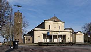 Gennep, church: de Sint Martinuskerk
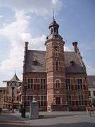 Gennep, former town hall
References
- "Burgemeester Dhr. P.J.H.M. De Koning" [Mayor Mr. P.J.H.M. De Koning] (in Dutch). Gemeente Gennep. Archived from the original on 17 October 2013. Retrieved 16 October 2013.
- "Kerncijfers wijken en buurten" [Key figures for neighbourhoods]. CBS Statline (in Dutch). CBS. 2 July 2013. Retrieved 12 March 2014.
- "Postcodetool for 6591CP". Actueel Hoogtebestand Nederland (in Dutch). Het Waterschapshuis. Archived from the original on 21 September 2013. Retrieved 16 October 2013.
- "Bevolkingsontwikkeling; regio per maand" [Population growth; regions per month]. CBS Statline (in Dutch). CBS. 1 January 2019. Retrieved 1 January 2019.
- Statistics Netherlands (CBS), Bevolkingskernen in Nederland 2001 "Archived copy". Archived from the original on 2006-03-19. Retrieved 2007-01-24.CS1 maint: archived copy as title (link). Statistics are for the continuous built-up area.
External links

- Official website
Places adjacent to Gennep | ||||||||||
|---|---|---|---|---|---|---|---|---|---|---|
| ||||||||||
| Authority control |
|---|