Gatsibo District
Gatsibo is a district (akarere) in Eastern Province, Rwanda. Its capital is Kabarore.
Gatsibo District | |
|---|---|
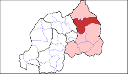 Shown within Eastern Province and Rwanda | |
| Country | Rwanda |
| Province | Eastern |
| Capital | Kabarore |
| Area | |
| • Total | 1,578 km2 (609 sq mi) |
| Population (2012 census) | |
| • Total | 433,020 |
| • Density | 270/km2 (710/sq mi) |
Geography
The district comprises areas in the north-east of Rwanda, between Kayonza and Nyagatare. The German post of Gatsibo was located here, as is the present-day Gabiro military camp. The eastern part of the district is in Akagera National Park, with the Kagera River forming the border with Tanzania.
Sectors
Gatsibo district is divided into 14 sectors (imirenge): Gasange, Gatsibo, Gitoki, Kabarore, Kageyo, Kiramuruzi, Kiziguro, Muhura, Murambi, Ngarama, Nyagihanga, Remera, Rugarama and Rwimbogo.
gollark: Troubling. Based on this, my model suggests that we'll reach server boost level -2 by October.
gollark: Idea: rebrand actual science things and/or interesting modern technology in clickbaity "free energy" ways.
gollark: > already have but it flies over your indoctrinated zombie coconutSee, this is probably a thing which makes people angry.
gollark: I'm actually Atheist, I worship the god Athe.
gollark: That is not how burden of proof works.
External links
- "Districts of Rwanda". Statoids.
- Gatsibo government website
This article is issued from Wikipedia. The text is licensed under Creative Commons - Attribution - Sharealike. Additional terms may apply for the media files.