Gakenke District
Gakenke is a district (akarere) in Northern Province, Rwanda. Its capital is Gakenke town.The district has started implementing a building plan with demarcation for land usage and public facilities.[1]
Gakenke District | |
|---|---|
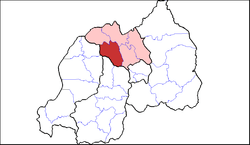 Shown within Northern Province and Rwanda | |
| Country | Rwanda |
| Province | Northern |
| Capital | Gakenke |
| Area | |
| • Total | 704 km2 (272 sq mi) |
| Population (2012 census) | |
| • Total | 338,234 |
| • Density | 480/km2 (1,200/sq mi) |
Sectors
Gakenke district is divided into 19 sectors (imirenge): Busengo, Coko, Cyabingo, Gakenke, Gashenyi, Mugunga, Janja, Kamubuga, Karambo, Kivuruga, Mataba, Minazi, Muhondo, Muyongwe, Muzo, Nemba, Ruli, Rusasa and Rushashi.
gollark: No idea, I'm not sure if CSS provides a better way at all?
gollark: Screen size in pixels? This is apiobee and not in a good way.
gollark: I hope you're not just using pixel size.
gollark: I see.
gollark: Well. It works, doesn't it? Did you invoke too many dark bee gods?
References
- "Districts of Rwanda". Statoids.
- Inzego.doc — Province, District and Sector information from MINALOC, the Rwanda ministry of local government.
- "Gakenke district gets new master plan". www.monpalais.com. Archived from the original on 10 July 2012. Retrieved 28 February 2012.
This article is issued from Wikipedia. The text is licensed under Creative Commons - Attribution - Sharealike. Additional terms may apply for the media files.