Gaskiers-Point La Haye
Gaskiers-Point La Haye is a town in Newfoundland and Labrador, Canada, located in St. Mary's Bay. It is located southwest of St. Mary's. It became a local government community in 1970. In 2011, the town had a population of 233.
Gaskiers-Point La Haye | |
|---|---|
Town | |
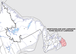
 Location of Gaskiers-Point la Haye in Newfoundland | |
| Coordinates: 46°52′N 53°37′W | |
| Country | |
| Province | |
| Incorporated | 1970 |
| Government | |
| • Mayor | Pearl Kielly |
| • MHA | Felix Collins (PC) |
| • MP | Scott Andrews (L) |
| Area | |
| • Land | 23.81 km2 (9.19 sq mi) |
| Population (2016) | |
| • Total | 232 |
| • Density | 9.7/km2 (25/sq mi) |
| Time zone | UTC-3:30 (Newfoundland Time) |
| • Summer (DST) | UTC-2:30 (Newfoundland Daylight) |
| Area code(s) | 709 |
| Highways | |
Local attractions
Hare Hill Trail (Point La Haye) is a well-developed trail that was originally used by wood cutters, hunters and berry pickers for centuries. The trail is a total of three kilometres long and reaches an elevation of 135 m at its highest point. Upon reaching the top, there is a view of many communities in St. Mary's Bay.
Towns and communities nearby
- Admiral's Beach
- Mosquito
- St. Mary's
- St. Vincent's-St. Stephen's-Peter's River
- Riverhead
gollark: Ask them to input their address...
gollark: It uses the kristpay wallet (I think) and that's shared for everyone.
gollark: I don't think you have access to the private key of the kristpay thing on the server.
gollark: `/deposit`
gollark: They'd have to input it.
See also
- St. Mary's Bay
- Newfoundland outport
- Avalon Peninsula
- List of cities and towns in Newfoundland and Labrador
References
This article is issued from Wikipedia. The text is licensed under Creative Commons - Attribution - Sharealike. Additional terms may apply for the media files.