Gasconade, Missouri
Gasconade is a city in Gasconade County, Missouri, United States. The population was 223 at the 2010 census.
Gasconade, Missouri | |
|---|---|
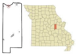 Location of Gasconade, Missouri | |
| Coordinates: 38°40′15″N 91°33′33″W | |
| Country | United States |
| State | Missouri |
| County | Gasconade |
| Area | |
| • Total | 0.20 sq mi (0.53 km2) |
| • Land | 0.20 sq mi (0.53 km2) |
| • Water | 0.00 sq mi (0.00 km2) |
| Elevation | 528 ft (161 m) |
| Population | |
| • Total | 223 |
| • Estimate (2019)[3] | 215 |
| • Density | 1,059.11/sq mi (409.03/km2) |
| Time zone | UTC-6 (Central (CST)) |
| • Summer (DST) | UTC-5 (CDT) |
| ZIP codes | 65036, 65061 |
| Area code(s) | 573 |
| FIPS code | 29-26578[4] |
| GNIS feature ID | 0729496[5] |
History
Gasconade was platted in 1857. It is situated at the mouth of the Gasconade River, from which it takes its name.[6]
The Gasconade Bridge train disaster was a rail accident that took place in Gasconade on November 1, 1855, when the Gasconade bridge collapsed under the weight of the O'Sullivan locomotive. Thirty-one people were killed.[7]
Geography
Gasconade is located at 38°40′15″N 91°33′33″W (38.670790, -91.559140).[8]
According to the United States Census Bureau, the city has a total area of 0.20 square miles (0.52 km2), all land.[9]
Demographics
| Historical population | |||
|---|---|---|---|
| Census | Pop. | %± | |
| 1930 | 375 | — | |
| 1940 | 494 | 31.7% | |
| 1950 | 448 | −9.3% | |
| 1960 | 333 | −25.7% | |
| 1970 | 235 | −29.4% | |
| 1980 | 250 | 6.4% | |
| 1990 | 253 | 1.2% | |
| 2000 | 267 | 5.5% | |
| 2010 | 223 | −16.5% | |
| Est. 2019 | 215 | [3] | −3.6% |
| U.S. Decennial Census[10] | |||
2010 census
As of the census[2] of 2010, there were 223 people, 97 households, and 57 families residing in the city. The population density was 1,115.0 inhabitants per square mile (430.5/km2). There were 138 housing units at an average density of 690.0 per square mile (266.4/km2). The racial makeup of the city was 99.1% White, 0.4% African American, and 0.4% from two or more races.
There were 97 households, of which 23.7% had children under the age of 18 living with them, 38.1% were married couples living together, 14.4% had a female householder with no husband present, 6.2% had a male householder with no wife present, and 41.2% were non-families. 33.0% of all households were made up of individuals, and 21.6% had someone living alone who was 65 years of age or older. The average household size was 2.30 and the average family size was 2.89.
The median age in the city was 46.3 years. 23.3% of residents were under the age of 18; 5.7% were between the ages of 18 and 24; 17.9% were from 25 to 44; 29.2% were from 45 to 64; and 23.8% were 65 years of age or older. The gender makeup of the city was 47.5% male and 52.5% female.
2000 census
As of the census[4] of 2000, there were 267 people, 105 households, and 72 families residing in the city. The population density was 1,280.5 people per square mile (490.9/km2). There were 141 housing units at an average density of 676.2 per square mile (259.2/km2). The racial makeup of the city was 96.63% White, 0.75% Native American, 1.12% Asian, and 1.50% from two or more races.
There were 105 households, out of which 23.8% had children under the age of 18 living with them, 47.6% were married couples living together, 16.2% had a female householder with no husband present, and 31.4% were non-families. 28.6% of all households were made up of individuals, and 17.1% had someone living alone who was 65 years of age or older. The average household size was 2.54 and the average family size was 3.04.
In the city the population was spread out, with 26.6% under the age of 18, 7.5% from 18 to 24, 22.8% from 25 to 44, 22.8% from 45 to 64, and 20.2% who were 65 years of age or older. The median age was 39 years. For every 100 females, there were 81.6 males. For every 100 females age 18 and over, there were 78.2 males.
The median income for a household in the city was $27,404, and the median income for a family was $27,917. Males had a median income of $22,045 versus $18,594 for females. The per capita income for the city was $13,131. About 19.7% of families and 25.4% of the population were below the poverty line, including 40.5% of those under the age of eighteen and 13.7% of those 65 or over.
See also
- List of cities and towns along the Missouri River
References
- "2019 U.S. Gazetteer Files". United States Census Bureau. Retrieved July 26, 2020.
- "U.S. Census website". United States Census Bureau. Retrieved 2012-07-08.
- "Population and Housing Unit Estimates". United States Census Bureau. May 24, 2020. Retrieved May 27, 2020.
- "U.S. Census website". United States Census Bureau. Retrieved 2008-01-31.
- "US Board on Geographic Names". United States Geological Survey. 2007-10-25. Retrieved 2008-01-31.
- Eaton, David Wolfe (1916). How Missouri Counties, Towns and Streams Were Named. The State Historical Society of Missouri. pp. 169.
- O'Neil, Tim (November 4, 2012). "Look Back: Disaster at bridge in 1855 derails St. Louis dream for a transcontinental railroad". Retrieved February 9, 2016.
- "US Gazetteer files: 2010, 2000, and 1990". United States Census Bureau. 2011-02-12. Retrieved 2011-04-23.
- "US Gazetteer files 2010". United States Census Bureau. Archived from the original on 2012-07-02. Retrieved 2012-07-08.
- "Census of Population and Housing". Census.gov. Retrieved June 4, 2015.
Municipalities and communities of Gasconade County, Missouri, United States | ||
|---|---|---|
| Cities | 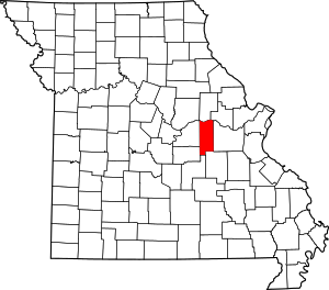 Map of Missouri highlighting Gasconade County | |
| Townships | ||
| Unincorporated community | ||
| Ghost towns | ||
| Footnotes | ‡This populated place also has portions in an adjacent county or counties | |