Garcon Point, Florida
Garcon Point is an unincorporated community and census-designated place in Santa Rosa County, Florida, United States. Its population was 347 as of the 2010 census.[1] The community is located on the peninsula of the same name.
Garcon Point, Florida | |
|---|---|
 Garcon Point, Florida  Garcon Point, Florida | |
| Coordinates: 30°28′33″N 87°05′24″W | |
| Country | United States |
| State | Florida |
| County | Santa Rosa |
| Area | |
| • Total | 1.937 sq mi (5.02 km2) |
| • Land | 1.889 sq mi (4.89 km2) |
| • Water | 0.048 sq mi (0.12 km2) |
| Elevation | 7 ft (2 m) |
| Population | |
| • Total | 347 |
| • Density | 180/sq mi (69/km2) |
| Time zone | UTC-6 (Central (CST)) |
| • Summer (DST) | UTC-5 (CDT) |
| Area code(s) | 850 |
| GNIS feature ID | 2629556[2] |
Geography
According to the U.S. Census Bureau, the community has an area of 1.937 square miles (5.02 km2); 1.889 square miles (4.89 km2) of its area is land, and 0.048 square miles (0.12 km2) is water.[1]
gollark: So I guess... add an IPC mechanism of some sort?
gollark: PotatOS has no IPC mechanism, so I just bodge it a lot of the time with queueEvent and stuff.
gollark: Hmm, that gave me a really good idea, 6_4.
gollark: I would recommend CraftOS-PC or CCEmuX for maximum Potatocompatibility™.
gollark: I'm still not entirely sure what you mean by that, but sure.
See also
References
- "2010 Census Gazetteer Files - Places: Florida". U.S. Census Bureau. Retrieved March 18, 2017.
- "Garcon Point Census Designated Place". Geographic Names Information System. United States Geological Survey.
Municipalities and communities of Santa Rosa County, Florida, United States | ||
|---|---|---|
| Cities | 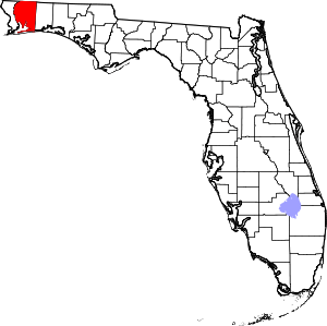 | |
| Town | ||
| CDPs |
| |
| Unincorporated communities | ||
This article is issued from Wikipedia. The text is licensed under Creative Commons - Attribution - Sharealike. Additional terms may apply for the media files.