Gallatin, Texas
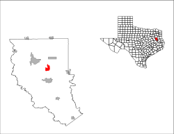
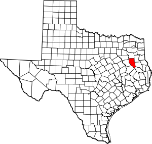
Gallatin is a city in Cherokee County, Texas, in the United States. The population was 419 at the 2010 census.
Gallatin, Texas | |
|---|---|
Location of Gallatin, Texas | |
 | |
| Coordinates: 31°54′12″N 95°9′2″W | |
| Country | United States |
| State | Texas |
| County | Cherokee |
| Government | |
| • Type | Mayor-Council |
| • Mayor | Chase Palmer |
| Area | |
| • Total | 4.60 sq mi (11.92 km2) |
| • Land | 4.60 sq mi (11.92 km2) |
| • Water | 0.00 sq mi (0.00 km2) |
| Elevation | 404 ft (123 m) |
| Population (2010) | |
| • Total | 419 |
| • Estimate (2019)[2] | 434 |
| • Density | 94.27/sq mi (36.40/km2) |
| Time zone | UTC-6 (Central (CST)) |
| • Summer (DST) | UTC-5 (CDT) |
| ZIP code | 75764 |
| Area code(s) | 903 430 |
| FIPS code | 48-28008[3] |
| GNIS feature ID | 1336348[4] |
Gallatin is an incorporated farming community at the junction of Farm roads 22 and 768, six miles north of Rusk in central Cherokee County.
History
The area was first settled in the late 1840s, but a community did not develop until 1902, when the Texas and New Orleans Railroad (T&NO) was built through the area. John W. Chandler and his sister, Sophronia, who owned the surrounding land, asked Rusk attorney C. H. Martin to survey a townsite. Chandler named the new town Gallatin, after his hometown of Gallatin, Tennessee. The new community, located in a large truck-farming area, quickly developed into a market for tomatoes and other produce. The construction in 1907 of a branch line of the T&NO between Gallatin and Rusk further enhanced the town as a shipping center.
By 1914 Gallatin had a population of 350, several churches, two general stores, a drugstore, a school, and a cotton gin. In 1916, virtually the entire business district was destroyed by fire, but the town was quickly rebuilt, and as late as the mid-1930s it reported 500 residents and five businesses.
After World War II, the community steadily declined. Its school was consolidated with the Rusk schools in the 1950s, and many of the town's businesses closed. The population fell to 350 by the early 1950s, and in 1990 only 171 residents and two stores were reported there. Nevertheless, Gallatin was incorporated in the early 1980s. In 1991, it had an estimated population of 382 and three businesses. In 2000, the population was 378 with four businesses.[5]
Geography
Gallatin is located at 31°54′12″N 95°9′2″W (31.903316, -95.150520).[6]
According to the United States Census Bureau, the city has a total area of 4.6 square miles (12 km2), all of it land.
Demographics
| Historical population | |||
|---|---|---|---|
| Census | Pop. | %± | |
| 1980 | 230 | — | |
| 1990 | 368 | 60.0% | |
| 2000 | 378 | 2.7% | |
| 2010 | 419 | 10.8% | |
| Est. 2019 | 434 | [2] | 3.6% |
| U.S. Decennial Census[7] | |||
At the 2010 census,[3] the population was 419.
At the 2000 census, the population was 378, in 146 households and 102 families. The population density was 90.3 per square mile (34.9/km2). There were 164 housing units at an average density of 35.7/sq mi (13.8/km2). The racial makeup of the city was 91.89% White, 2.34% African American, 0.72% Asian, 1.91% from other races, and 1.43% from two or more races. Hispanic or Latino of any race were 6.68% of the population.
There were 146 households of which 36.3% had children under the age of 18 living with them, 58.2% were married couples living together, 8.2% had a female householder with no husband present, and 29.5% were non-families. 27.4% of all households were made up of individuals and 11.6% had someone living alone who was 65 years of age or older. The average household size was 2.59 and the average family size was 3.16.
31.2% of the population were under the age of 18, 6.1% from 18 to 24, 27.8% from 25 to 44, 21.4% from 45 to 64, and 13.5% who were 65 years of age or older. The median age was 33 years. For every 100 females, there were 98.9 males. For every 100 females age 18 and over, there were 89.8 males.
The median household income was $25,714 and the median family income for a family was $31,875. Males had a median income of $31,250 and females $19,107. The per capita income was $10,350. About 16.3% of families and 20.7% of the population were below the poverty line, including 23.9% of those under age 18 and 26.8% of those age 65 or over.
Education
Most of the City of Gallatin is served by the Rusk Independent School District.A small portion of the town is also within the Jacksonville ISD.
Notable people
- Johnny Horton, singer-songwriter, who graduated from the high school at Gallatin before going on to Lon Morris College in Jacksonville, Texas.[8]
References
- "2019 U.S. Gazetteer Files". United States Census Bureau. Retrieved August 7, 2020.
- "Population and Housing Unit Estimates". United States Census Bureau. May 24, 2020. Retrieved May 27, 2020.
- "U.S. Census website". United States Census Bureau. Retrieved 2008-01-31.
- "US Board on Geographic Names". United States Geological Survey. 2007-10-25. Retrieved 2008-01-31.
- https://tshaonline.org/handbook/online/articles/hlg02
- "US Gazetteer files: 2010, 2000, and 1990". United States Census Bureau. 2011-02-12. Retrieved 2011-04-23.
- "Census of Population and Housing". Census.gov. Retrieved June 4, 2015.
- http://www.texasescapes.com/AllThingsHistorical/Honky-Tonk-Man-Johnny-Horton-AM106.htm
