Galicia Peak
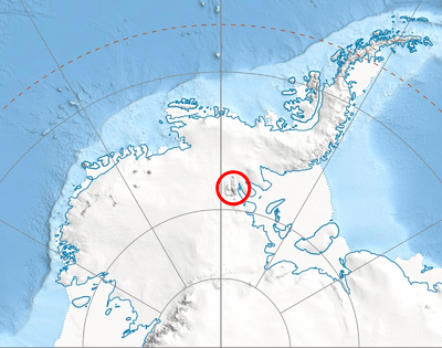
Galicia Point[1] (Bulgarian: връх Галисия, romanized: vrah Galisiya, IPA: [ˈvrɤɣ ɡɐˈlisijɐ]; Spanish: Punta Galicia; Galician: Punta Galicia or Punta Galiza) is the peak rising to 4500 m in Vinson Massif, Sentinel Range in Ellsworth Mountains, Antarctica, and surmounting Jacobsen Valley to the east and Branscomb Glacier to the north and west.
| Galicia Point | |
|---|---|
 Galicia Point | |
| Highest point | |
| Elevation | 4,557 m (14,951 ft) |
| Coordinates | 78°30′30″S 85°42′00″W |
| Geography | |
| Location | Antarctica |
| Parent range | Sentinel Range |
The peak is named after the Spanish region of Galicia in connection with the peak's ascent by the Spaniard Miguel Ángel Vidal on 28 December 2004.
Location
Galicia Peak is located at 78°30′30″S 85°42′00″W, which is 5.02 km south of Mount Shinn (4661 m), 2.62 km north-northwest of the summit Mount Vinson (4892 m), 840 m north of Branscomb Peak (4520 m) and 5.5 km east-southeast of Knutzen Peak (3373 m). US mapping in 1961, 1988 and 2007.
See also
- Mountains in Antarctica
Maps
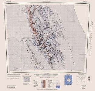
- Vinson Massif. Scale 1:250 000 topographic map. Reston, Virginia: US Geological Survey, 1988.
- D. Gildea and C. Rada. Vinson Massif and the Sentinel Range. Scale 1:50 000 topographic map. Omega Foundation, 2007.
- Antarctic Digital Database (ADD). Scale 1:250000 topographic map of Antarctica. Scientific Committee on Antarctic Research (SCAR). Since 1993, regularly updated.
Notes
- "Spaniards on Vinson debrief: New routes and names". Archived from the original on 2008-05-16. Explorersweb, 26 January 2005.
References
- Bulgarian Antarctic Gazetteer. Antarctic Place-names Commission. (details in Bulgarian, basic data in English)
- Galicia Peak. SCAR Composite Gazetteer of Antarctica.
External links
- Galicia Peak. Copernix satellite image
This article includes information from the Antarctic Place-names Commission of Bulgaria which is used with permission.
| General |
| .svg.png) |
|---|---|---|
| Geographic regions | ||
| Waterways | ||
| Famous explorers | ||