Fults, Illinois
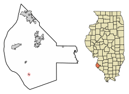
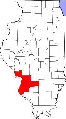
Fults is a village in the Renault precinct of Monroe County, Illinois, United States. The population was 44 at the 2010 census. It is located entirely within the American Bottom floodplain.
Fults | |
|---|---|
Village | |
| Etymology: Jacob Fults, early settler | |
 Location of Fults in Monroe County, Illinois. | |
.svg.png) Location of Illinois in the United States | |
| Coordinates: 38°9′56″N 90°12′52″W | |
| Country | United States |
| State | Illinois |
| County | Monroe |
| Precinct | 13 |
| Founded | April 12, 1937 |
| Area | |
| • Total | 0.05 sq mi (0.14 km2) |
| • Land | 0.05 sq mi (0.14 km2) |
| • Water | 0.00 sq mi (0.00 km2) |
| Population (2010) | |
| • Total | 26 |
| • Estimate (2019)[2] | 28 |
| • Density | 528.30/sq mi (204.80/km2) |
| Time zone | UTC-6 (CST) |
| • Summer (DST) | UTC-5 (CDT) |
| ZIP Code(s) | 62244 |
| Area code(s) | 618 |
| FIPS code | 17-28170 |
| Wikimedia Commons | Fults, Illinois |
Geography
Fults is located at 38°9′56″N 90°12′52″W (38.165688, -90.214395).[3]
According to the 2010 census, the village has a total area of 0.07 square miles (0.18 km2), all land.[4]
History
The village was named after Jacob Fults, born in Pennsylvania in 1793, to German immigrants. Fults, after leaving the service of the United States during the War of 1812 in 1817, settled on Moredock Lake. He then moved to the Renault precinct, first up Braun's Hollow, then in 1829 to the settlement known at the time as Braunsberg, which would eventually take his name, until his death in 1841.
A site on the bluffs just north of Fults, overlooking the Bottoms is known as Saltpetre Cave and took its name from the quantities of bat guano mined there for potassium nitrate which was used in the local manufacture of black powder by the French at Fort de Chartres and later inhabitants. This cave, cut into the side of the bluffs, and an excellent defensive position, was one of the last refuges for Native Americans in the region.[5] It was a popular site in the area for rappelling and hiking, until access to it was restricted in the aftermath of the Great Flood of 1993 and several accidents at the site.
Demographics
| Historical population | |||
|---|---|---|---|
| Census | Pop. | %± | |
| 1940 | 88 | — | |
| 1950 | 120 | 36.4% | |
| 1960 | 90 | −25.0% | |
| 1970 | 101 | 12.2% | |
| 1980 | 78 | −22.8% | |
| 1990 | 45 | −42.3% | |
| 2000 | 28 | −37.8% | |
| 2010 | 26 | −7.1% | |
| Est. 2019 | 28 | [2] | 7.7% |
| U.S. Decennial Census[6] | |||
As of the census[7] of 2000, there were 28 people, 9 households, and 8 families residing in the village. The population density was 411.2 people per square mile (154.4/km2). There were 10 housing units at an average density of 146.9 per square mile (55.2/km2). The racial makeup of the village was 100.00% White.
There were 9 households, out of which 33.3% had children under the age of 18 living with them, 88.9% were married couples living together, and 11.1% were non-families. No households were made up of individuals, and none had someone living alone who was 65 years of age or older. The average household size was 3.11 and the average family size was 3.25.
In the village, the population was spread out, with 21.4% under the age of 18, 21.4% from 18 to 24, 25.0% from 25 to 44, 28.6% from 45 to 64, and 3.6% who were 65 years of age or older. The median age was 41 years. For every 100 females there were 100.0 males. For every 100 females age 18 and over, there were 120.0 males.
The median income for a household in the village was $47,813, and the median income for a family was $48,438. Males had a median income of $33,750 versus $0 for females. The per capita income for the village was $11,389. None of the population and none of the families were below the poverty line.
References
- "2019 U.S. Gazetteer Files". United States Census Bureau. Retrieved July 14, 2020.
- "Population and Housing Unit Estimates". United States Census Bureau. May 24, 2020. Retrieved May 27, 2020.
- "US Gazetteer files: 2010, 2000, and 1990". United States Census Bureau. 2011-02-12. Retrieved 2011-04-23.
- "2010 Census U.S. Gazetteer Files for Places – Illinois". United States Census. Archived from the original on 2013-01-12. Retrieved 2012-10-13.
- Combined History of Randolph, Monroe and Perry Counties, Illinois, J. L. McDonough & Co., Philadelphia, 1883
- "Census of Population and Housing". Census.gov. Retrieved June 4, 2015.
- "U.S. Census website". United States Census Bureau. Retrieved 2008-01-31.
