Froid, Montana
Froid is a town in Roosevelt County, Montana, United States. The population was 185 at the 2010 census.[4] Froid was named for the French word for "cold".[5]
Froid, Montana | |
|---|---|
| Motto(s): "Last Best Place" | |
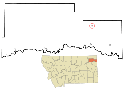 Location of Froid, Montana | |
| Coordinates: 48°20′9″N 104°29′25″W | |
| Country | United States |
| State | Montana |
| County | Roosevelt |
| Area | |
| • Total | 0.62 sq mi (1.62 km2) |
| • Land | 0.62 sq mi (1.62 km2) |
| • Water | 0.00 sq mi (0.00 km2) |
| Elevation | 2,031 ft (619 m) |
| Population | |
| • Total | 185 |
| • Estimate (2019)[3] | 203 |
| • Density | 325.32/sq mi (125.69/km2) |
| Time zone | UTC-7 (Mountain (MST)) |
| • Summer (DST) | UTC-6 (MDT) |
| ZIP code | 59226 |
| Area code(s) | 406 |
| FIPS code | 30-29500 |
| GNIS feature ID | 0771647 |
History
The land that is now Froid was homesteaded by James and Alice Baker, and who erected a building that housed a dry goods store, livery stable, and meat house. One family currently residing in Froid (the Johnsons) are descendants of this couple.
Froid was incorporated in 1910.[6] The town made headlines in 2007, when Governor Brian Schweitzer gave the commencement address to the high school graduating class, which consisted entirely of one student, Roxie Britton. The act received considerable soft news coverage for this distinction.[7]
Geography
Froid is located at 48°20′9″N 104°29′25″W (48.335950, -104.490264),[8] near the North Dakota border and north of Culbertson, Montana, on Highway 16.
According to the United States Census Bureau, the town has a total area of 0.28 square miles (0.73 km2), all of it land.[9]
Demographics
| Historical population | |||
|---|---|---|---|
| Census | Pop. | %± | |
| 1920 | 410 | — | |
| 1930 | 434 | 5.9% | |
| 1940 | 441 | 1.6% | |
| 1950 | 555 | 25.9% | |
| 1960 | 418 | −24.7% | |
| 1970 | 330 | −21.1% | |
| 1980 | 323 | −2.1% | |
| 1990 | 195 | −39.6% | |
| 2000 | 195 | 0.0% | |
| 2010 | 185 | −5.1% | |
| Est. 2019 | 203 | [3] | 9.7% |
| U.S. Decennial Census | |||
2010 census
As of the census[2] of 2010, there were 185 people, 92 households, and 49 families residing in the town. The population density was 660.7 inhabitants per square mile (255.1/km2). There were 117 housing units at an average density of 417.9 per square mile (161.4/km2). The racial makeup of the town was 97.3% White, 0.5% Native American, and 2.2% from two or more races.
There were 92 households, of which 21.7% had children under the age of 18 living with them, 46.7% were married couples living together, 5.4% had a female householder with no husband present, 1.1% had a male householder with no wife present, and 46.7% were non-families. 43.5% of all households were made up of individuals, and 21.8% had someone living alone who was 65 years of age or older. The average household size was 2.01 and the average family size was 2.84.
The median age in the town was 50.9 years. 23.2% of residents were under the age of 18; 1.7% were between the ages of 18 and 24; 16.2% were from 25 to 44; 31.3% were from 45 to 64; and 27.6% were 65 years of age or older. The gender makeup of the town was 45.4% male and 54.6% female.
2000 census
As of the census[10] of 2000, there were 195 people, 97 households, and 51 families residing in the town. The population density was 688.1 people per square mile (268.9/km2). There were 122 housing units at an average density of 430.5 per square mile (168.2/km2). The racial makeup of the town was 90.77% White, 5.64% Native American, 1.54% from other races, and 2.05% from two or more races. Hispanic or Latino of any race were 1.54% of the population.
There were 97 households, out of which 20.6% had children under the age of 18 living with them, 41.2% were married couples living together, 4.1% had a female householder with no husband present, and 47.4% were non-families. 45.4% of all households were made up of individuals, and 29.9% had someone living alone who was 65 years of age or older. The average household size was 2.01 and the average family size was 2.88.
In the town, the population was spread out, with 24.6% under the age of 18, 2.1% from 18 to 24, 21.5% from 25 to 44, 24.1% from 45 to 64, and 27.7% who were 65 years of age or older. The median age was 48 years. For every 100 females there were 114.3 males. For every 100 females age 18 and over, there were 96.0 males.
The median income for a household in the town was $24,583, and the median income for a family was $31,250. Males had a median income of $21,111 versus $16,875 for females. The per capita income for the town was $15,021. About 11.8% of families and 7.6% of the population were below the poverty line, including 2.0% of those under the age of eighteen and 7.1% of those 65 or over.
References
- "2019 U.S. Gazetteer Files". United States Census Bureau. Retrieved July 26, 2020.
- "U.S. Census website". United States Census Bureau. Retrieved 2012-12-18.
- "Population and Housing Unit Estimates". United States Census Bureau. May 24, 2020. Retrieved May 27, 2020.
- "2010 Census Redistricting Data (Public Law 94-171) Summary File". American FactFinder. United States Census Bureau. Retrieved 2 May 2011.
- "Montana Place Names Companion". Montana Place Names From Alzada to Zortman. Montana Historical Society Research Center. Retrieved 9 May 2011.
- "Our Story: Highlights of the Life and Times of Froid". Town of Froid. Retrieved January 12, 2009.
- "Governor Speaks to Graduating Class of One". Billings Gazette. 2007-05-15. Retrieved 2007-09-22.
- "US Gazetteer files: 2010, 2000, and 1990". United States Census Bureau. 2011-02-12. Retrieved 2011-04-23.
- "US Gazetteer files 2010". United States Census Bureau. Archived from the original on 2012-07-02. Retrieved 2012-12-18.
- "U.S. Census website". United States Census Bureau. Retrieved 2008-01-31.
External links
- "Official city website". Town of Froid, Montana.
Municipalities and communities of Roosevelt County, Montana, United States | ||
|---|---|---|
| Cities | 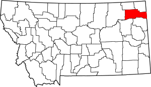 Roosevelt County map | |
| Towns | ||
| Indian reservations | ||
| Ghost town | ||
| Footnotes | ‡This populated place also has portions in an adjacent county or counties | |