Fort Belknap (Texas)
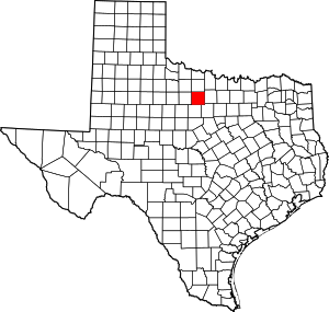
Fort Belknap, located near Newcastle, Texas, was established in November 1851[3] by brevet Brigadier William G. Belknap to protect the Texas frontier against raids by the Kiowa and Comanche. It was the northernmost fort in a line from the Rio Grande to the Red River. The fort functioned as a base of operations rather than as a fortified point, and it became the center of a substantial network of roads, including the Butterfield Overland Mail. The fort was designated a National Historic Landmark in 1960, in recognition of its key role in securing the Texas frontier in the 1850s and 1860s.[4]
Fort Belknap | |
.jpg) Flags and artillery at Fort Belknap. | |
 Fort Belknap  Fort Belknap | |
| Nearest city | Newcastle, Texas |
|---|---|
| Coordinates | 33°9′2.79″N 98°44′28.36″W |
| Area | 15.3 acres (6.2 ha) |
| Built | June 24, 1851 |
| NRHP reference No. | 66000824[1] |
| Significant dates | |
| Added to NRHP | October 15, 1966 |
| Designated NHL | December 19, 1960[2] |
Other forts in the frontier fort system were Forts Griffin, Concho, Richardson, Chadbourne, Stockton, Davis, Bliss, McKavett, Clark, McIntosh, Inge, and Phantom Hill in Texas, and Sill in Oklahoma.[5] Subposts or intermediate stations also were used, including Bothwick's Station on Salt Creek between Fort Richardson and Fort Belknap, Camp Wichita near Buffalo Springs between Fort Richardson and Red River Station, and Mountain Pass between Fort Concho and Fort Griffin.[3]
Some notable officers who were stationed at Fort Belknap include Captain Randolph B. Marcy and Lieutenant George B. McClellan. Together, the officers explored the Canadian River and found the headwaters of the Red River. The Second Cavalry was headquartered here in 1858.[6]:210
Prior to the outbreak of the American Civil War, the post was abandoned, partly as a pullback of federal troops to the north, and partly due to the fort's unreliable water supply. "Northern indians fell upon the hapless Texas frontier with such violence that a whole tier of frontier counties was disbanded..."[6]:291 Families remaining in Young County "huddled in the abandoned buildings of Fort Belknap" and "during snow storms sought shelter in the abandoned buildings."[6]:291
The fort was briefly reoccupied in 1867, then abandoned for the last time.[7]
The fort was gradually dismantled for building materials, so that by 1936, only the magazine and part of the cornhouse remained. Beginning with the Texas Centennial, portions of the fort were rebuilt and restored, mostly on their original foundations. The fort is home to the Fort Belknap Archives, which house records from North Texas.[8]
Gallery
 An 1853 map of the fort by Lt. Col. W.G. Freeman
 Entrance
 Fort Belknap historical marker
 Magazine marker
 CSA marker
See also
References
- "National Register Information System". National Register of Historic Places. National Park Service. July 9, 2010.
- "Fort Belknap". National Historic Landmark summary listing. National Park Service. Archived from the original on 2009-11-13. Retrieved 2008-06-25.
- Carter, R.G., On the Border with Mackenzie, 1935, Washington D.C.: Enyon Printing Co., p. 49
- "NHL nomination for Fort Belknap". National Park Service. Retrieved 2018-01-03.
- Carter, R.G., On the Border with Mackenzie, 1935, Washington D.C.: Enyon Printing Co., p. 48
- Neighbours, K.F., 1975, Robert Neighbors and the Texas Frontier, 1836-1859, Waco: Texian Press
- Kenneth F. Neighbours, "FORT BELKNAP", Handbook of Texas Online, Texas State Historical Association, retrieved 1 May 2013
- "Fort Belknap, Texas".
| Wikimedia Commons has media related to Fort Belknap. |


