Flower Hill, New York
Flower Hill is a village in Nassau County, New York in the United States. The eastern half is considered part of the Greater Roslyn area, which is anchored by the Village of Roslyn. Western and northern parts are more closely associated with Manhasset and Port Washington. The population was 4,665 at the 2010 census.
Flower Hill, New York | |
|---|---|
Village | |
| Village of Flower Hill | |
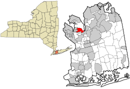
 Location in Nassau County and the state of New York. | |
 Flower Hill, New York Location within the state of New York | |
| Coordinates: 40°48′21″N 73°40′29″W | |
| Country | United States |
| State | New York |
| County | Nassau |
| Area | |
| • Total | 1.62 sq mi (4.20 km2) |
| • Land | 1.62 sq mi (4.20 km2) |
| • Water | 0.00 sq mi (0.00 km2) |
| Elevation | 167 ft (51 m) |
| Population (2010) | |
| • Total | 4,665 |
| • Estimate (2019)[2] | 4,889 |
| • Density | 3,016.04/sq mi (1,164.33/km2) |
| Time zone | UTC-5 (Eastern (EST)) |
| • Summer (DST) | UTC-4 (EDT) |
| FIPS code | 36-26352 |
| GNIS feature ID | 0950308 |
| Website | www |
The Village of Flower Hill is in the Town of North Hempstead.
History
The George W. Denton House on West Shore Road was listed on the National Register of Historic Places in 1985.[3] Austrian actor Walter Slezak lived in this area until his death. The Mayor of Flower Hill, Elaine Phillips, was elected to the New York State Senate on November 8, 2016.[4]
Geography

Flower Hill is located at 40°48′21″N 73°40′29″W.[5]
According to the United States Census Bureau, the village has a total area of 1.6 square miles (4.1 km2), all of it land.
Demographics
| Historical population | |||
|---|---|---|---|
| Census | Pop. | %± | |
| 1940 | 666 | — | |
| 1950 | 1,948 | 192.5% | |
| 1960 | 4,594 | 135.8% | |
| 1970 | 4,486 | −2.4% | |
| 1980 | 4,558 | 1.6% | |
| 1990 | 4,490 | −1.5% | |
| 2000 | 4,508 | 0.4% | |
| 2010 | 4,665 | 3.5% | |
| Est. 2019 | 4,889 | [2] | 4.8% |
| U.S. Decennial Census[6] | |||
At the 2000 census there were 4,508 people, 1,477 households, and 1,271 families in the village. The population density was 2,790.2 people per square mile (1,074.4/km2). There were 1,514 housing units at an average density of 937.1 per square mile (360.8/km2). The racial makeup of the village was 85.65% White, 1.04% African American, 0.02% Native American, 10.31% Asian, 0.98% from other races, and 2.00% from two or more races. Hispanic or Latino of any race were 4.02%.[7]
Of the 1,477 households 39.3% had children under the age of 18 living with them, 78.1% were married couples living together, 5.9% had a female householder with no husband present, and 13.9% were non-families. 11.8% of households were one person and 6.9% were one person aged 65 or older. The average household size was 3.03 and the average family size was 3.29.
The age distribution was 26.1% under the age of 18, 5.8% from 18 to 24, 22.8% from 25 to 44, 29.0% from 45 to 64, and 16.3% 65 or older. The median age was 42 years. For every 100 females, there were 94.9 males. For every 100 females age 18 and over, there were 91.2 males.
The median household income was $121,999 and the median family income was $133,075. Males had a median income of $100,000 versus $49,688 for females. The per capita income for the village was $64,997. About 2.0% of families and 2.9% of the population were below the poverty line, including 1.7% of those under age 18 and 3.5% of those age 65 or over.
References
- "2019 U.S. Gazetteer Files". United States Census Bureau. Retrieved July 27, 2020.
- "Population and Housing Unit Estimates". United States Census Bureau. May 24, 2020. Retrieved May 27, 2020.
- "National Register Information System". National Register of Historic Places. National Park Service. March 13, 2009.
- "Elaine Phillips Wins New York's 7th Senate District". Port Washington, NY Patch. Retrieved 2016-11-10.
- "US Gazetteer files: 2010, 2000, and 1990". United States Census Bureau. 2011-02-12. Retrieved 2011-04-23.
- "Census of Population and Housing". Census.gov. Retrieved June 4, 2015.
- "U.S. Census website". United States Census Bureau. Retrieved 2008-01-31.