Flat Lick, Kentucky
Flat Lick is an unincorporated community and census-designated place (CDP) in Knox County, Kentucky, United States. As of the 2010 census, the population was 960.[2]
Flat Lick, Kentucky | |
|---|---|
 Flat Lick  Flat Lick | |
| Coordinates: 36°49′44″N 83°46′13″W | |
| Country | United States |
| State | Kentucky |
| County | Knox |
| Area | |
| • Total | 4.78 sq mi (12.39 km2) |
| • Land | 4.78 sq mi (12.38 km2) |
| • Water | 0.004 sq mi (0.01 km2) |
| Elevation | 1,040 ft (320 m) |
| Population (2010) | |
| • Total | 960 |
| • Density | 201/sq mi (77.5/km2) |
| Time zone | UTC-5 (Eastern (EST)) |
| • Summer (DST) | UTC-4 (EDT) |
| ZIP code | 40935 |
| Area code(s) | 606 |
| FIPS code | 21-27730 |
| GNIS feature ID | 492198[1] |
The oldest community in the county, Flat Lick was settled before 1784 and named for a salty rock which attracted wild animals.[3]
Geography
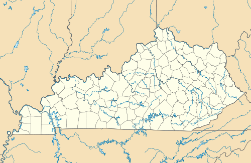
Flat Lick is in eastern Knox County, northeast of the Cumberland River. U.S. Route 25E forms the western edge of the CDP; the highway leads northwest 9 miles (14 km) to Barbourville, the county seat, and southeast 7 miles (11 km) to Pineville.
According to the U.S. Census Bureau, the Flat Lick CDP has an area of 4.8 square miles (12.4 km2), of which 1.7 acres (6,760 m2), or 0.05%, are water.[2]
gollark: Can't you get it yourself now?
gollark: gogle.cloud is good, yes.
gollark: Which I would* use.
gollark: Maybe I should attain a coral-like domain like `60.nu`.
gollark: Well, I could use one of my cloud™ servers, but spam filters.
References
- U.S. Geological Survey Geographic Names Information System: Flat Lick, Kentucky
- "Geographic Identifiers: 2010 Demographic Profile Data (G001): Flat Lick CDP, Kentucky". American Factfinder. U.S. Census Bureau. Retrieved March 7, 2019.
- Rennick, Robert M. (1987). Kentucky Place Names. University Press of Kentucky. p. 102. ISBN 0813126312. Retrieved 2013-04-28.
Municipalities and communities of Knox County, Kentucky, United States | ||
|---|---|---|
| Cities | 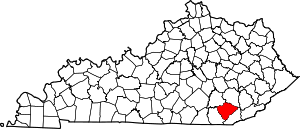 Location of Knox County, Kentucky | |
| CDPs | ||
| Other unincorporated communities | ||
| Ghost towns | ||
| Footnotes | ‡This populated place also has portions in an adjacent county | |
This article is issued from Wikipedia. The text is licensed under Creative Commons - Attribution - Sharealike. Additional terms may apply for the media files.