Finnish national road 54
The Finnish national road 54 (Finnish: Kantatie 54; Swedish: Stamväg 54) is the 2nd class main route between the municipalities of Hollola and Tammela in southern Finland.[1][2] It runs from Airikkala in Hollola passes through the Riihimäki town and little part of Hämeenlinna town to the national road 10 in Tammela, where it turns into a smaller regional road going to the Teuro village.
| |
|---|---|
| |
| Kantatie 54, Stamväg 54 | |
 | |
| Route information | |
| Maintained by the Finnish Transport Agency | |
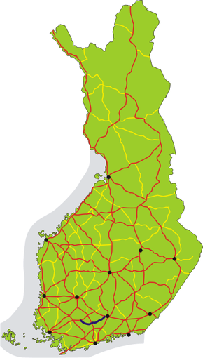
| Length | 97 km (60 mi) |
| Major junctions | |
| From | Hollola |
| To | Tammela |
| Location | |
| Major cities | Riihimäki |
| Highway system | |
| Highways in Finland | |

Route
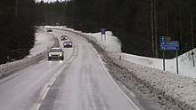
The Finnish national road 54 at Hämeenlinna, near the crossroad of Härkätie.
The road passes through the following localities:
- Hollola (Airikkala)
- Kärkölä (Kärkölä and Lappila)
- Hausjärvi (Mommila, Oitti and Karhi)
- Riihimäki
- Loppi (Kormu, Launonen, Loppi, Topeno and Vojakkala)
- Hämeenlinna (Lietsa)
- Tammela
gollark: Fan headers?
gollark: A CPU socket?
gollark: Regular USB ports?
gollark: Regular SATA ports?
gollark: Postgres is good.
References
- Kantatie 54 (in Finnish)
- Kantatie 54 Tammela-Hollola (in Finnish)
External links

This article is issued from Wikipedia. The text is licensed under Creative Commons - Attribution - Sharealike. Additional terms may apply for the media files.