Fatu-Hiva
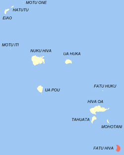
Fatu-Hiva (the "H" is not pronounced, see name section below) is the southernmost island of the Marquesas Islands, in French Polynesia, an overseas territory of France in the Pacific Ocean. With Motu Nao as its closest neighbor, it is also the most isolated of the inhabited islands.
Fatu-Hiva | |
|---|---|
 Location of the commune (in red) within the Marquesas Islands | |
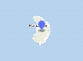
Location of Fatu-Hiva 
| |
| Coordinates: 10°29′00″S 138°38′00″W | |
| Country | France |
| Overseas collectivity | French Polynesia |
| Subdivision | Marquesas Islands |
| Government | |
| • Mayor | Henri Tuieinui |
| Area 1 | 85 km2 (33 sq mi) |
| Population (2017) | 612 |
| • Density | 7.2/km2 (19/sq mi) |
| Time zone | UTC−09:30 |
| INSEE/Postal code | 98718 /98740 |
| Elevation | 0–1,125 m (0–3,691 ft) |
| 1 French Land Register data, which excludes lakes, ponds, glaciers > 1 km2 (0.386 sq mi or 247 acres) and river estuaries. | |
Fatu Hiva is also the title of a book by explorer and archaeologist Thor Heyerdahl, in which he describes his stay on the island in the 1930s.
Name
The name of the island in Marquesan is Fatu Iva (without "h": [ˈfatu ˈiva]). However, the name was recorded by Europeans as Fatu-Hiva, perhaps under the influence of other Marquesan islands containing the element Hiva (Nuku-Hiva and Hiva-Oa) and also because in French the letter "h" is silent. The spelling Fatu-Hiva has now become official.
The island was named Isla Magdalena ("Magdalene Island") by Spanish explorers in the 16th century, a name rarely used.
Geography

The eastern coastline of Fatu-Hiva is characterized by a number of narrow valleys, carved by streams that lead to the interior. Between these valleys are headlands which terminate in cliffs that plunge directly into the sea, making travel between them possible only by travelling over the high mountain ridges between them, or by boat. The largest of these valleys is at Uia.
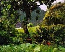
The western coastline has two significant bays, Hana Vave (also known as Bay of Virgins or Baie des Vierges) in the north, one of the most picturesque sites in the South Pacific, and the well-protected harbor of Omoa near the south. There are several smaller valleys between these two.
The center of the island is a plateau which is covered largely by tall grasses and pandanus trees. To the south of the plateau, running to the south, is a mountain ridge, called Tauauoho, its highest peak, at 1,125 m (3,691 ft.) is the highest point on Fatu-Hiva. Proceeding to the north and northwest from the plateau is a mountain ridge called Fa‘e One, the highest peak of which is 820 m (2,690 ft.).
History
European exploration
The first recorded sighting of Fatu-Hiva by the Europeans was by the Spanish expedition of Álvaro de Mendaña on 21 July 1595. They charted it as Magdalena.[1]
Administration
Administratively Fatu-Hiva forms the commune (municipality) of Fatu-Hiva, part of the administrative subdivision of the Marquesas Islands.[2] This commune consists solely of the island of Fatu-Hiva itself.[3] The administrative centre of the commune is the settlement of Omoa,[3] on the south-western side of the island.
Demographics
The population of Fatu-Hiva was 612 at the 2017 census,[4] primarily spread across three villages:
References
- Sharp, Andrew The discovery of the Pacific Islands Clarendon Press, Oxford, 1960, p.51.
- Décret n° 2005-1611 du 20 décembre 2005 pris pour l'application du statut d'autonomie de la Polynésie française Archived 2019-03-27 at the Wayback Machine, Légifrance
- Décret n°72-407 du 17 mai 1972 portant création de communes dans le territoire de la Polynésie française Archived 2019-12-21 at the Wayback Machine, Légifrance
- Répartition de la population en Polynésie française en 2017 Archived 2018-10-24 at the Wayback Machine, Institut de la statistique de la Polynésie française
| Wikimedia Commons has media related to Fatu-Hiva. |