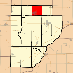
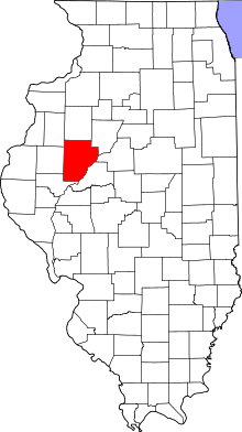
Fairview Township, Fulton County, Illinois
Fairview Township is one of 26 townships in Fulton County, in the U.S. state of Illinois. As of the 2010 census, its population was 698 and it contained 303 housing units.[2]
Fairview Township | |
|---|---|
 Location in Fulton County | |
 Fulton County's location in Illinois | |
| Coordinates: 40°40′09″N 90°09′02″W | |
| Country | United States |
| State | Illinois |
| County | Fulton |
| Established | November 6, 1849 |
| Area | |
| • Total | 35.94 sq mi (93.1 km2) |
| • Land | 35.53 sq mi (92.0 km2) |
| • Water | 0.41 sq mi (1.1 km2) 1.14% |
| Elevation | 696 ft (212 m) |
| Population (2010) | |
| • Estimate (2016)[1] | 655 |
| • Density | 19.6/sq mi (7.6/km2) |
| Time zone | UTC-6 (CST) |
| • Summer (DST) | UTC-5 (CDT) |
| ZIP codes | 61432, 61520, 61531, 61544 |
| FIPS code | 17-057-25076 |
Geography
According to the 2010 census, the township has a total area of 35.94 square miles (93.1 km2), of which 35.53 square miles (92.0 km2) (or 98.86%) is land and 0.41 square miles (1.1 km2) (or 1.14%) is water.[2]
Cities, towns, villages
- Fairview
- Oak Mound (no longer exists)
- Parrville
Cemeteries
The township contains these five cemeteries: Coal Creek, Fairview, Lyons, Markley and Shumaker.
Major highways
School districts
- Farmington Central Community Unit School District 265
- Spoon River Valley Community Unit School District 4
Political districts
- Illinois' 17th congressional district
- State House District 91
- State Senate District 46
gollark: Wikipedia says everyone has two ACTN3s but some of the versions are different.
gollark: Did you sequence your genes at some point, or something?
gollark: You can get vitamin D supplements quite easily nowadays.
gollark: Never mind, they both do but inconsistently, apparently.
gollark: I wonder how they implemented that.
References
- "Fairview Township, Fulton County, Illinois". Geographic Names Information System. United States Geological Survey. Retrieved 2010-01-16.
- United States Census Bureau 2007 TIGER/Line Shapefiles
- United States National Atlas
- "Population and Housing Unit Estimates". Retrieved June 9, 2017.
- "Population, Housing Units, Area, and Density: 2010 - County -- County Subdivision and Place -- 2010 Census Summary File 1". United States Census. Archived from the original on 2020-02-12. Retrieved 2013-05-28.
- "Census of Population and Housing". Census.gov. Retrieved June 4, 2016.
External links
This article is issued from Wikipedia. The text is licensed under Creative Commons - Attribution - Sharealike. Additional terms may apply for the media files.