Fairmount, Colorado
Fairmount is a census-designated place (CDP) in Jefferson County, Colorado, United States. The population as of the 2010 census was 7,559.[2]
Fairmount, Colorado | |
|---|---|
 Fairmount  Fairmount | |
| Coordinates: 39°47′26″N 105°10′28″W | |
| Country | |
| State | |
| County | Jefferson |
| Government | |
| • Type | Unincorporated community |
| Area | |
| • Total | 6.2 sq mi (16.0 km2) |
| • Land | 6.0 sq mi (15.5 km2) |
| • Water | 0.2 sq mi (0.5 km2) |
| Elevation | 5,595 ft (1,705 m) |
| Population (2010) | |
| • Total | 7,559 |
| • Density | 1,261/sq mi (486.8/km2) |
| Time zone | UTC-7 (MST) |
| • Summer (DST) | UTC-6 (MDT) |
| ZIP Code | 81050 |
| Area code(s) | 303 and 720 |
| FIPS code | 08-25550 |
| GNIS feature ID | 2583234 |
Geography
Fairmount is bordered to the north by Arvada, to the east by Wheat Ridge, to the south by unincorporated Applewood, and to the west by Golden and undeveloped land on North Table Mountain.
The southeast corner of the Fairmount CDP touches Interstate 70, which leads east 8 miles (13 km) into Denver.
According to the U.S. Census Bureau, the CDP has a total area of 6.2 square miles (16.0 km2), of which 6.0 square miles (15.5 km2) are land and 0.2 square miles (0.5 km2), or 3.21%, are water.[2]
Demographics
| Historical population | |||
|---|---|---|---|
| Census | Pop. | %± | |
| U.S. Decennial Census[3] | |||
gollark: Well, I duckduckgoed it and something came up, although you could just not do things which make you repeatedly get banned.
gollark: Oh, it's a windows thing.
gollark: ... what do you mean "HWID"?
gollark: A what?
gollark: 😃? <:smiles:725046901174567103>?
See also
- Outline of Colorado
- State of Colorado
- Colorado cities and towns
- Colorado census designated places
- Colorado counties
- Colorado metropolitan areas
- Front Range Urban Corridor
- North Central Colorado Urban Area
- Denver-Aurora-Boulder, CO Combined Statistical Area
- Denver-Aurora-Broomfield, CO Metropolitan Statistical Area
- Colorado cities and towns
References
- "US Board on Geographic Names". United States Geological Survey. 2007-10-25. Retrieved 2008-01-31.
- "Geographic Identifiers: 2010 Census Summary File 1 (G001): Fairmount CDP, Colorado". American Factfinder. U.S. Census Bureau. Archived from the original on February 13, 2020. Retrieved April 26, 2018.
- "Census of Population and Housing". Census.gov. Retrieved June 4, 2016.
Municipalities and communities of Jefferson County, Colorado, United States | ||
|---|---|---|
| Cities | 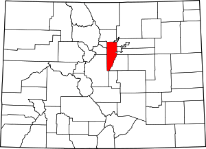 Map of Colorado highlighting Jefferson County | |
| Towns | ||
| CDPs | ||
| Unincorporated communities | ||
| Ghost town | ||
| Footnotes | ‡This populated place also has portions in an adjacent county or counties | |
This article is issued from Wikipedia. The text is licensed under Creative Commons - Attribution - Sharealike. Additional terms may apply for the media files.