Erawan National Park
Erawan National Park (Thai: อุทยานแห่งชาติเอราวัณ) is a 550 km2 park in western Thailand in the Tenasserim Hills of Kanchanaburi Province, Amphoe Si Sawat in tambon Tha Kradan. Founded in 1975, it was Thailand's 12th national park.
| Erawan National Park | |
|---|---|
IUCN category II (national park) | |
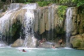 Erawan Waterfall | |
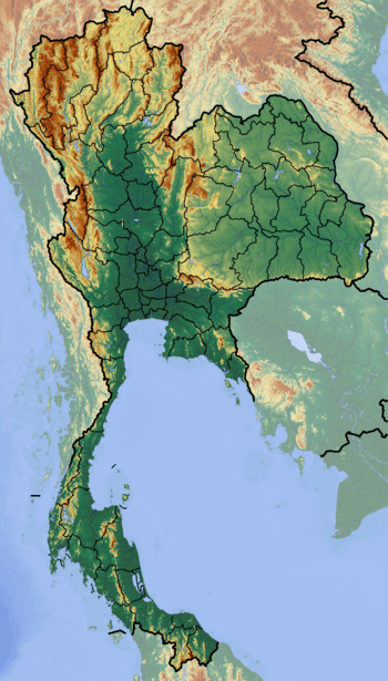 Map of Thailand | |
| Location | Kanchanaburi Province, Thailand |
| Nearest city | Kanchanaburi |
| Coordinates | 14°23′N 99°07′E |
| Area | 550 km² |
| Established | 1975 |
| Governing body | Department of National Park, Wildlife and Plant Conservation (DNP) |
Features
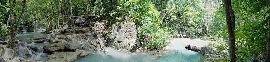
The major attraction of the park is Erawan Falls, a waterfall named after the erawan, the three-headed white elephant of Hindu mythology. The seven-tiered falls are said to resemble the erawan.[1]
There are four caves in the park: Mi, Rua, Wang Bahdan, and Phartat.[2] Rising northeast of the waterfall area there is a breast-shaped hill named Khao Nom Nang.[3]
gollark: We do definitely need sanified CSS though.
gollark: It'd never work anyway.
gollark: I wouldn't go that far.
gollark: I do web development but have no design skill at all. Making stuff look good is *hard*.
gollark: Go is like Lisp but different and worse.
References
- Elliot, Stephan; Cubitt, Gerald (2001). THE NATIONAL PARKS and other Wild Places of THAILAND. New Holland Publishers (UK) Ltd. pp. 32–35. ISBN 9781859748862.
- Erawan National Park Archived December 8, 2006, at the Wayback Machine
- Roadway Thailand Atlas, Groovy Map Co., Ltd. © 4/2010
External links
| Wikimedia Commons has media related to Erawan National Park. |
This article is issued from Wikipedia. The text is licensed under Creative Commons - Attribution - Sharealike. Additional terms may apply for the media files.