Elmira, Missouri
Elmira is a village in Ray County, Missouri, and part of the Kansas City metropolitan area within the United States. The population was 50 at the 2010 census.[6]
Elmira, Missouri | |
|---|---|
| Nickname(s): Elmira Bluejays | |
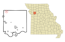 Location of Elmira, Missouri | |
| Coordinates: 39°30′32″N 94°9′17″W | |
| Country | United States |
| State | Missouri |
| County | Ray |
| Area | |
| • Total | 0.07 sq mi (0.19 km2) |
| • Land | 0.07 sq mi (0.19 km2) |
| • Water | 0.00 sq mi (0.00 km2) |
| Elevation | 955 ft (291 m) |
| Population | |
| • Total | 50 |
| • Estimate (2019)[3] | 50 |
| • Density | 684.93/sq mi (265.66/km2) |
| Time zone | UTC-6 (Central (CST)) |
| • Summer (DST) | UTC-5 (CDT) |
| ZIP code | 64062 |
| Area code(s) | 816 |
| FIPS code | 29-22006[4] |
| GNIS feature ID | 0717545[5] |
The Battle of Crooked River in the Mormon War was fought two miles southeast of the village.
History
Elmira had its start as a mining settlement.[7] The town site was platted in 1887.[8] The village was named after Elmira, New York.[9] A post office called Elmira was established in 1887, and remained in operation until 1959.[10]
Geography
Elmira is located at 39°30′32″N 94°9′17″W (39.509003, -94.154623).[11]
According to the United States Census Bureau, the village has a total area of 0.07 square miles (0.18 km2), all land.[12]
Demographics
| Historical population | |||
|---|---|---|---|
| Census | Pop. | %± | |
| 1930 | 187 | — | |
| 1940 | 159 | −15.0% | |
| 1950 | 128 | −19.5% | |
| 1960 | 123 | −3.9% | |
| 1970 | 124 | 0.8% | |
| 1980 | 109 | −12.1% | |
| 1990 | 70 | −35.8% | |
| 2000 | 82 | 17.1% | |
| 2010 | 50 | −39.0% | |
| Est. 2019 | 50 | [3] | 0.0% |
| U.S. Decennial Census[13] | |||
2010 census
As of the census[2] of 2010, there were 50 people, 18 households, and 14 families residing in the village. The population density was 714.3 inhabitants per square mile (275.8/km2). There were 22 housing units at an average density of 314.3 per square mile (121.4/km2). The racial makeup of the village was 90.0% White, 2.0% from other races, and 8.0% from two or more races. Hispanic or Latino of any race were 8.0% of the population.
There were 18 households, of which 22.2% had children under the age of 18 living with them, 66.7% were married couples living together, 11.1% had a male householder with no wife present, and 22.2% were non-families. 22.2% of all households were made up of individuals, and 11.2% had someone living alone who was 65 years of age or older. The average household size was 2.78 and the average family size was 3.07.
The median age in the village was 47.5 years. 12% of residents were under the age of 18; 8% were between the ages of 18 and 24; 28% were from 25 to 44; 44% were from 45 to 64; and 8% were 65 years of age or older. The gender makeup of the village was 54.0% male and 46.0% female.
2000 census
As of the census[4] of 2000, there were 82 people, 29 households, and 22 families residing in the village. The population density was 331.3 people per square mile (126.6/km2). There were 33 housing units at an average density of 133.3 per square mile (51.0/km2). The racial makeup of the village was 93.90% White, 2.44% Native American, and 3.66% from two or more races.
There were 29 households, out of which 27.6% had children under the age of 18 living with them, 62.1% were married couples living together, 17.2% had a female householder with no husband present, and 20.7% were non-families. 13.8% of all households were made up of individuals, and 10.3% had someone living alone who was 65 years of age or older. The average household size was 2.83 and the average family size was 3.13.
In the village, the population was spread out, with 29.3% under the age of 18, 7.3% from 18 to 24, 31.7% from 25 to 44, 25.6% from 45 to 64, and 6.1% who were 65 years of age or older. The median age was 36 years. For every 100 females, there were 95.2 males. For every 100 females age 18 and over, there were 81.3 males.
The median income for a household in the village was $49,375, and the median income for a family was $50,833. Males had a median income of $40,625 versus $16,667 for females. The per capita income for the village was $14,785. There were 10.0% of families and 20.2% of the population living below the poverty line, including 29.4% of under eighteens and 50.0% of those over 64.
References
- "2019 U.S. Gazetteer Files". United States Census Bureau. Retrieved July 26, 2020.
- "U.S. Census website". United States Census Bureau. Retrieved 2012-07-08.
- "Population and Housing Unit Estimates". United States Census Bureau. May 24, 2020. Retrieved May 27, 2020.
- "U.S. Census website". United States Census Bureau. Retrieved 2008-01-31.
- "US Board on Geographic Names". United States Geological Survey. 2007-10-25. Retrieved 2008-01-31.
- "Race, Hispanic or Latino, Age, and Housing Occupancy: 2010 Census Redistricting Data (Public Law 94-171) Summary File (QT-PL), Elmira village, Missouri". United States Census Bureau. Retrieved September 6, 2011.
- "Ray County Place Names, 1928–1945". The State Historical Society of Missouri. Archived from the original on June 24, 2016. Retrieved December 12, 2016.
- Eaton, David Wolfe (1917). How Missouri Counties, Towns and Streams Were Named. The State Historical Society of Missouri. pp. 344.
- Ramsay, Robert L. (1952). Our Storehouse of Missouri Place Names. University of Missouri Press. p. 25.
- "Post Offices". Jim Forte Postal History. Retrieved 12 December 2016.
- "US Gazetteer files: 2010, 2000, and 1990". United States Census Bureau. 2011-02-12. Retrieved 2011-04-23.
- "US Gazetteer files 2010". United States Census Bureau. Archived from the original on 2012-01-25. Retrieved 2012-07-08.
- "Census of Population and Housing". Census.gov. Retrieved June 4, 2015.
Municipalities and communities of Ray County, Missouri, United States | ||
|---|---|---|
| Cities | 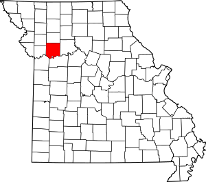 Map of Missouri highlighting Ray County | |
| Villages | ||
| Townships | ||
| CDP | ||
| Other unincorporated communities | ||
| Ghost town | ||
| Footnotes | ‡This populated place also has portions in an adjacent county or counties | |