Elm (hills)
The Elm (![]()
| Elm | |
|---|---|
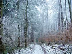 Elm in winter | |
| Highest point | |
| Peak | Eilumer Horn |
| Elevation | 323 m (1,060 ft) |
| Geography | |
 | |
| Country | Germany |
| Region | Lower Saxony |
| Geology | |
| Orogeny | Triassic |
| Type of rock | Muschelkalk limestone |
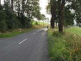
The Elm range is a popular area for motor cyclists
The Elm is a popular among hikers, cyclists, and motor cyclists.
Rivers originating in the Elm include:
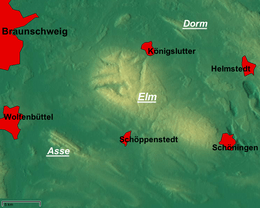
Towns on the edge of the Elm include:
Elevations
- Eilumer Horn (323,3 m)
- Osterberg (c. 314 m)
- Drachenberg (c. 313 m)
- Burgberg (c. 311 m)
- Amplebener Berg (310 m)
- Kleiner Tafelberg (c. 302 m)
- Kiefelhorn (301 m)
- Großer Tafelberg (296 m)
- Warberg (290 m)
- Wolfsburger Kopf (289 m)
Sources
- Heinz-Bruno Krieger: Elmsagen. Oeding, Braunschweig-Schöppenstedt 1967.
- Heinz Röhr: Der Elm. Oeding, Braunschweig-Schöppenstedt 1962.

Mountain and hill ranges of Lower Saxony | ||
|---|---|---|
| North German Plain | 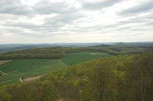 | |
| Harz Mountains |
| |
| Lower Weser Uplands |
| |
| Weser-Leine Uplands |
| |
| East Hesse Highlands | ||
gollark: You'd need multiple random GPU boxes.
gollark: Anyway, probably *some* people would pay for random GPU boxes with internet access, but probably hobbyists and I don't know how you'd sell to them.
gollark: It's direct attach or something.
gollark: Which the internet is not.
gollark: Because it isn't viable, because most of the interesting stuff to do with lots of GPUs requires them to be linked over very good network links.
This article is issued from Wikipedia. The text is licensed under Creative Commons - Attribution - Sharealike. Additional terms may apply for the media files.