Electoral district of Rowville
The electoral district of Rowville is an electoral district of the Victorian Legislative Assembly in Australia. It was created in the redistribution of electoral boundaries in 2013, and came into effect at the 2014 state election.[1]
| Rowville Victoria—Legislative Assembly | |
|---|---|
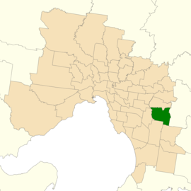 Location of Rowville (dark green) in Greater Melbourne | |
| State | Victoria |
| Created | 2014 |
| MP | Kim Wells |
| Party | Liberal |
| Electors | 39,893 (2018) |
| Area | 53 km2 (20.5 sq mi) |
| Demographic | Metropolitan |
It largely covers the area of the abolished district of Scoresby, covering eastern suburbs of Melbourne. It includes the suburbs of Rowville, Lysterfield, Ferntree Gully, Scoresby and Knoxfield.[2]
The abolished seat of Scoresby was held by Liberal MP Kim Wells, who retained the new seat at the 2014 election.
Election results
| Party | Candidate | Votes | % | ± | |
|---|---|---|---|---|---|
| Liberal | Kim Wells | 17,551 | 50.39 | −3.45 | |
| Labor | Muhammad Shahbaz | 11,940 | 34.28 | −1.37 | |
| Greens | Natasha Sharma | 3,483 | 10.00 | +2.63 | |
| Independent | Joe Cossari | 1,858 | 5.33 | +5.33 | |
| Total formal votes | 34,832 | 94.04 | −0.42 | ||
| Informal votes | 2,207 | 5.96 | +0.42 | ||
| Turnout | 37,039 | 92.85 | −2.13 | ||
| Two-party-preferred result | |||||
| Liberal | Kim Wells | 19,373 | 55.69 | −2.72 | |
| Labor | Muhammad Shahbaz | 15,416 | 44.31 | +2.72 | |
| Liberal hold | Swing | −2.72 | |||
gollark: That would make sense.
gollark: I'm not hip and with it (yo) when it comes to all these... generation name things? What's a "doomer"?
gollark: I do generally prefer flying to cars for reasonably long distances, but the whole "security" thing at airports really does a great job at making me reevaluate that. And is not actually improving security at all.
gollark: How does hyperloop compare to regular maglevs?
gollark: The Thought Police ~~would like to~~ know your location.
References
- "Summary of Changes". Victorian Electoral Boundary Commission. Archived from the original on 17 October 2013. Retrieved 17 October 2013.
- "Map of Rowville District". Victorian Electoral Boundaries Commission.
- State Election 2018: Rowville District, VEC.
External links
This article is issued from Wikipedia. The text is licensed under Creative Commons - Attribution - Sharealike. Additional terms may apply for the media files.