East End of Rundle
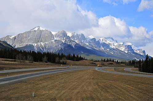
East End of Rundle (EEOR) is a mountain located immediately west of the town of Canmore, Alberta and immediately west of the Spray Lakes road in the Canadian Rockies. Mount Rundle occupies the space between Canmore and Banff on the southwest side of the Trans-Canada Highway.
| East End of Rundle (EEOR) | |
|---|---|
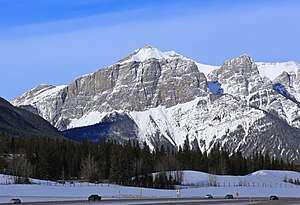 East End of Rundle seen from westbound Highway 1 | |
| Highest point | |
| Elevation | 2,590 m (8,500 ft) [1] |
| Coordinates | 51°04′50″N 115°25′19″W [2] |
| Geography | |
 East End of Rundle (EEOR) Location in Alberta  East End of Rundle (EEOR) East End of Rundle (EEOR) (Canada) | |
| Location | Alberta, Canada |
| Parent range | South Banff Ranges, Canadian Rockies |
| Topo map | NTS 82O/3 Canmore[1] |
| Climbing | |
| Easiest route | easy/moderate scramble[1] |
There is a scrambling route up from the Spray Lakes road.[1]
Geology
The mountain is composed of sedimentary rock laid down during the Precambrian to Jurassic periods.[3] Formed in shallow seas, this sedimentary rock was pushed east and over the top of younger rock during the Laramide orogeny.[4]
Climate
Based on the Köppen climate classification, the mountain is located in a subarctic climate with cold, snowy winters, and mild summers.[5] Temperatures can drop below −20 °C with wind chill factors below −30 °C. Precipitation runoff from Rundle drains into the Bow River which is a tributary of the Saskatchewan River.
References
- Kane, Alan (1999). "East End of Rundle". Scrambles in the Canadian Rockies. Calgary: Rocky Mountain Books. p. 73. ISBN 0-921102-67-4.
- "East End of Rundle". Peakbagger.com. Retrieved 2019-09-15.
- Belyea, Helen R. (1960). The Story of the Mountains in Banff National Park (PDF). parkscanadahistory.com (Report). Ottawa: Geological Survey of Canada. Archived (PDF) from the original on 2015-10-02. Retrieved 2019-09-13.
- Gadd, Ben (2008). "Geology of the Rocky Mountains and Columbias". Missing or empty
|url=(help) - Peel, M. C.; Finlayson, B. L. & McMahon, T. A. (2007). "Updated world map of the Köppen−Geiger climate classification". Hydrol. Earth Syst. Sci. 11: 1633–1644. ISSN 1027-5606.
Gallery
 Mount Rundle with the East End to left
 EEOR (left) and Ha-Ling (right) viewed from the South with Canmore in the background (Sept. 2006)
External links
- Scramble description from www.scrambling.ca
- "East End of Rundle". Peakware.com. Archived from the original on 2016-03-04.