Eagle-Vail, Colorado
Eagle-Vail is a former census-designated place (CDP) and unincorporated community in Eagle County, Colorado, United States, along Interstate 70 and the Eagle River. The population was 2,887 at the 2000 census. The area was not returned separately by census enumerators in 2010.[1] The area is located in the heart of the Eagle River Valley in Eagle County. Located between Vail and Avon, Eagle-Vail is a residential community of 1,400+ homes with a diverse mix of year-round residents and second homeowners. Eagle Vail is managed by the Eagle-Vail Metro District and Eagle-Vail Property Owners Association and is the site of the Eagle-Vail Golf Club.
Eagle-Vail, Colorado | |
|---|---|
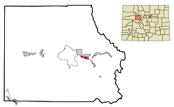 Location in Eagle County and the state of Colorado | |
| Coordinates: 39°37′17″N 106°29′32″W | |
| Country | |
| State | |
| County | Eagle |
| Area | |
| • Total | 2 sq mi (5.1 km2) |
| • Land | 2 sq mi (5.1 km2) |
| • Water | 0 sq mi (0 km2) |
| Population (2000) | |
| • Total | 2,887 |
| • Density | 1,443.5/sq mi (566.1/km2) |
| Time zone | UTC-7 (MST) |
| • Summer (DST) | UTC-6 (MDT) |
| ZIP code | 81620 (Avon) |
| FIPS code | 08-22225 |
Geography
 Eagle-Vail is along I-70 in Eagle County. |
Eagle-Vail is located at 39°37′17″N 106°29′32″W.[2]
According to the United States Census Bureau in 2000, the CDP had a total area of 2.0 square miles (5.2 km2).
Demographics
| Historical population | |||
|---|---|---|---|
| Census | Pop. | %± | |
| 1990 | 1,922 | — | |
| 2000 | 2,887 | 50.2% | |
| source:[3] | |||
At the 2000, census[4] there were 2,887 people, 1,083 households and 552 families residing in the CDP. The population density was 1,461.4 per square mile (564.2/km2). There were 1,482 housing units at an average density of 750.2 per square mile (289.7/km2). The racial make-up was 95.84% White, 0.28% African American, 0.35% Native American, 0.45% Asian, 0.07% Pacific Islander, 1.04% from other races, and 1.97% from two or more races. Hispanic or Latino of any race were 4.50% of the population.
There were 1,083 households of which 28.2% had children under the age of 18 living with them, 43.3% were married couples living together, 5.4% had a female householder with no husband present, and 49.0% were non-families. 19.2% of all households were made up of individuals, and 0.6% had someone living alone who was 65 years of age or older. The average household size was 2.66 and the average family size was 2.98.
18.8% of the population were under the age of 18, 10.5% from 18 to 24, 49.5% from 25 to 44, 19.5% from 45 to 64, and 1.7% who were 65 years of age or older. The median age was 31 years. For every 100 females, there were 120.2 males. For every 100 females age 18 and over, there were 127.2 males.
The median household income was $87,297 and the median family income was $92,190. Males had a median income of $40,599 and females $35,489. The per capita income was $37,260. None of the families and 3.0% of the population were living below the poverty line, including no under eighteens and 7.5% of those over 64.
Eagle Vail transportation
Vail is served by Eagle County Airport, which is near Gypsum. Native Americans used to call the area near this airport the "hole in the sky" because storms seemed to avoid it.
![]()
References
- Colorado Trend Report 2: State and Complete Places (Sub-state 2010 Census Data). Archived 11 July 2012 at Archive.today Missouri Census Data Center. Retrieved 25 February 2011.
- "US Gazetteer files: 2010, 2000, and 1990". United States Census Bureau. 12 February 2011. Retrieved 23 April 2011.
- "CENSUS OF POPULATION AND HOUSING (1790-2000)". U.S. Census Bureau. Retrieved 17 July 2010.
- "U.S. Census website". United States Census Bureau. Retrieved 2008-01-31.
External links
- Eagle-Vail community website
- Vail Daily News official website
- Vail Valley Partnership The Chamber and Tourism Bureau
- Eagle-Vail Golf Course
Municipalities and communities of Eagle County, Colorado, United States | ||
|---|---|---|
| Towns | 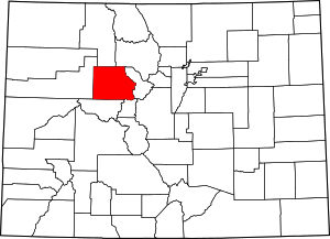 Map of Colorado highlighting Eagle County | |
| CDPs | ||
| Unincorporated communities | ||
| Ghost towns | ||
| Footnotes | ‡This populated place also has portions in an adjacent county or counties | |