EZRide
The EZRide shuttle is a bus service run by the Charles River Transportation Management Association. It operates from North Station in Boston, Massachusetts to Fort Washington/Cambridgeport via Lechmere, Kendall Square, and University Park at MIT, serving over 25 identified stops.[1]
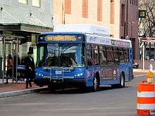
An EZRide bus at Kendall/MIT station in December 2015
Buses are operated by Paul Revere Transportation. Service runs from North Station to Cambridgeport at rush hour and from Kendall/MIT station to Cambridgeport during midday. There is no night or weekend service. Real-time predicted arrival information is available through NextBus and smartphone apps. Route maps are available on the buses, at some stops, and online.[1]
Major stops
| Stop | Connections/Notes |
|---|---|
| North Station Nashua Street behind O'Neill Building |
Commuter rail: Fitchburg Line, Haverhill/Reading Line, Lowell Line, Newburyport/Rockport Line Subway: Orange Line, Green Line (C and E branches) Amtrak: Downeaster Bus: 4 (World Trade Center via Federal Courthouse and South Station) |
| Lechmere First Street at Otis Street |
Subway: Green Line (E branch) at Lechmere Bus: 69 (Harvard/Holyoke Gate via Cambridge Street), 80 (Arlington Center via Medford Hillside), 87 (Arlington Center or Clarendon Hill via Somerville Avenue), 88 (Clarendon Hill via Highland Avenue) |
| First Street First Street at Charles Street |
CambridgeSide Galleria nearby |
| Kendall Square | Subway: Red Line at Kendall/MIT (MBTA station) Bus: CT2 (Sullivan Square or Ruggles), 64 (Oak Square via North Beacon Street and Central Square, rush hours only), 68 (Harvard/Holyoke Gate via Broadway), 85 (Spring Hill via Summer Street and Union Square) |
| University Park North Inbound: Sidney Street at Green Street Outbound: Sidney Street at Franklin Street |
Bus: 1, 47, 64, 70, 70A, 83, 91 |
| Cambridgeport | Bus: 47 |
gollark: Coltrans is maybe me though. We never resolved that.
gollark: Apioform #25.
gollark: Would you like a soul? I have spares.
gollark: I am gollark, yes.
gollark: Cool.
References
- "Route Map & Stop Guide". Charles River Transportation Management Association. Charles River Transportation Management Association, Inc. Retrieved 2016-02-21.
This article is issued from Wikipedia. The text is licensed under Creative Commons - Attribution - Sharealike. Additional terms may apply for the media files.