Dundas Parish, New Brunswick
Dundas is a civil parish[lower-alpha 1] in Kent County, New Brunswick, Canada. For governance purposes it is divided between the rural community of Cocagne and the local service districts of Grande-Digue, Shediac Bridge-Shediac River, the parish of Dundas, and (through its Saint-Grégoire special service area) the parish of Wellington.
Dundas | |
|---|---|
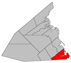 Location within Kent County, New Brunswick. | |
| Coordinates: 46.27°N 64.86°W | |
| Country | |
| Province | |
| County | Kent |
| Established | 1826 |
| Area | |
| • Land | 174.63 km2 (67.43 sq mi) |
| Population (2016)[1] | |
| • Total | 3,914 |
| • Density | 22.4/km2 (58/sq mi) |
| • Change 2011-2016 | |
| • Dwellings | 2,529 |
| Time zone | UTC-4 (AST) |
| • Summer (DST) | UTC-3 (ADT) |
The parish is informally called Notre-Dame after one its communities.
Delineation
Dundas Parish is defined in the Territorial Division Act[2] as being bounded:
- South by the County line; west by the McLaughlin Road;[lower-alpha 2] north by a line beginning at the seashore, at the northeastern angle of lot no. 1, granted to Joseph Richard; thence south seventy-two degrees and thirty minutes west seven hundred and sixty-five chains, or until it meets the westerly line of lot number 86, granted to Maximin A. Girouard; thence along the western line of said lot in a southerly direction, to meet the southern line of lot number 84, granted to Beloni Robicheau; thence westerly along the said southern line of the last-mentioned grant and its westerly prolongation to the eastern side of the McLaughlin Road; and east by the Gulf of Saint Lawrence, including all the islands in front.
Communities
Parish population total does not include incorporated municipalities (in bold):
|
|
Demographics
Population
|
LanguageMother tongue (2016)[1]
|
gollark: It wouldn't allow teleporting. Unless you could ship spatial IO cells by drone or railgun.
gollark: It is unminecraftuous.
gollark: I dislike it.
gollark: No.
gollark: Not all rails. You could run fossil fuel trains or ship batteries with electric trains.
See also
Notes
- Civil parishes served a variety of government functions until 1966, when the new Municipalities Act stripped them of their responsibilities; they continue to provide convenient boundaries for government uses, especially electoral districts and local service districts. Statistics Canada uses civil parishes as census subdivisions for all parts of the province that are not within municipalities and similar entities.
- Route 490
References
- "Census Profile, 2016 Census Dundas, Parish [Census subdivision], New Brunswick". Statistics Canada. Retrieved September 13, 2019.
- "Territorial Division Act (R.S.N.B. 1973, c. T-3)". Government of New Brunswick website. Retrieved 19 August 2016.
- Statistics Canada: 1996, 2001, 2006 census
- 2011 Statistics Canada Census Profile: Dundas Parish, New Brunswick
External links
Places adjacent to Dundas Parish, New Brunswick | ||||||||||
|---|---|---|---|---|---|---|---|---|---|---|
| ||||||||||
| Subdivisions |
|
|---|---|
| Cities | |
| Counties | |
| |
This article is issued from Wikipedia. The text is licensed under Creative Commons - Attribution - Sharealike. Additional terms may apply for the media files.