Dun Cruinn
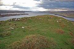
Dun Cruinn is a prehistoric site about 10 kilometres (6.2 mi) north-west of Portree, on the Isle of Skye, Scotland. It is on the Skerinish Peninsula, between Loch Snizort Beag and Loch Eyre.
 Looking north-northwest at the site, between Loch Snizort Beag (on the left) and Loch Eyre | |
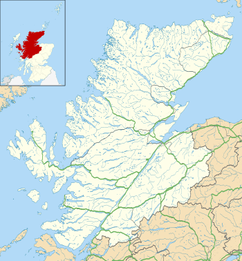
 Shown within Highland | |
| Location | Isle of Skye, Scotland grid reference NG 411 518 |
|---|---|
| Coordinates | 57°28′58″N 6°19′17″W |
| Type | Dun |
| History | |
| Periods | Iron Age |
| Reference no. | SM910[1] |
Description
There is a fort on a rocky knoll: it is an irregular oval, about 95 metres (312 ft) north-northwest to south-southeast, by 25 metres (82 ft), enclosing a area of about 0.19 hectares (0.47 acres). The wall of the fort is now seen as a band of rubble, about 3 metres (9.8 ft) thick, best preserved in the north. It is divided about midway by a rampart and ditch.[2]
In the south of the fort are the remains of a dun (or broch), built later than the fort, diameter about 20 metres (66 ft) and having a maximum height of 1.5 metres (4.9 ft).[2]
gollark: It should be decided by my social status decider algorithm™.
gollark: I don't know if there's actually some meaningful mechanism underlying it or whether it's just an aggregate of a bunch of things, but still.
gollark: It apparently correlates with a bunch of things.
gollark: Why does the infvalues one say "I have an IQ above 120"?
gollark: Wow!
References
- Historic Environment Scotland. "Dun Cruinn, fort, Kensaleyre (SM910)". Retrieved 30 May 2020.
- "Archaeology Notes"; "Field Visit (20 April 2015 – 22 April 2015)"; "Note (21 January 2015 – 18 October 2016)" from Atlas of Hillforts of Britain and Ireland. Contained in: Historic Environment Scotland. "Dun Cruinn, Skye (11332)". Canmore. Retrieved 19 November 2019.
This article is issued from Wikipedia. The text is licensed under Creative Commons - Attribution - Sharealike. Additional terms may apply for the media files.