Dumfries Parish, New Brunswick
Dumfries is a civil parish[lower-alpha 1] in York County, New Brunswick, Canada.[2]
Dumfries | |
|---|---|
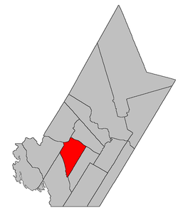 Location within York County, New Brunswick. | |
| Coordinates: 45.965°N 67.15°W | |
| Country | |
| Province | |
| County | York |
| Established | 1833 |
| Area | |
| • Land | 302.72 km2 (116.88 sq mi) |
| Population (2016)[1] | |
| • Total | 356 |
| • Density | 1.2/km2 (3/sq mi) |
| • Change 2011-2016 | |
| • Dwellings | 334 |
| Time zone | UTC-4 (AST) |
| • Summer (DST) | UTC-3 (ADT) |
For governance purposes it forms the local service district of the parish of Dumfries.[3]
Delineation
Dumfries Parish is defined in the Territorial Division Act[2] as being bounded:
- Southeast by Prince William Parish; northeast by the Saint John River; west and northwest by the upper sideline of lot numbered six, granted to John Benn, and a line running southwesterly from the southwest angle thereof, parallel to the upper line of Prince William Parish; and southwest by eastern lines of the grants to the New Brunswick and Canada Railway and Land Company, east of the Canadian Pacific Railroad, being commonly called "The Belt Line," and the said Belt Line being continued northerly as surveyed by Deputy Alfred Whitehead, in the year one thousand eight hundred and fifty-nine.
Governance
The entire parish forms the local service district of the parish of Dumfries, established in 1966 to assess for fire protection. Community services were added to the assessment in 1967 and first aid and ambulance services in 1978.
Communities
Parish population total does not include incorporated municipalities (in bold):
Demographics
Population
|
LanguageMother tongue (2016)[1]
|
gollark: You will become apioforms accordingly.
gollark: I'm glad you agree with me.
gollark: LyricLy should really be banned from participating if they're going to keep accessing this kind of information.
gollark: ALL of which are mine.
gollark: No you don't.
See also
Notes
- Civil parishes served a variety of government functions until 1966, when the new Municipalities Act stripped them of their responsibilities; they continue to provide convenient boundaries for government uses, especially electoral districts and local service districts. Statistics Canada uses civil parishes as census subdivisions for all parts of the province that are not within municipalities and similar entities.
References
- "Census Profile, 2016 Census Dumfries, Parish [Census subdivision], New Brunswick". Statistics Canada. Retrieved October 7, 2019.
- "Chapter T-3 Territorial Division Act". Government of New Brunswick. Retrieved 25 July 2020.
- "New Brunswick Regulation 84-168 under the Municipalities Act (O.C. 84-582)". Government of New Brunswick. Retrieved 25 July 2020.
- Statistics Canada: 1996, 2001, 2006 census
- 2006 Statistics Canada Community Profile: Dumfries Parish, New Brunswick
- 2011 Statistics Canada Census Profile: Dumfries Parish, New Brunswick
Places adjacent to Dumfries Parish, New Brunswick | |
|---|---|
| Subdivisions |
|
|---|---|
| Cities | |
| Counties | |
| |
This article is issued from Wikipedia. The text is licensed under Creative Commons - Attribution - Sharealike. Additional terms may apply for the media files.