Canterbury Parish, New Brunswick
Canterbury is a civil parish[lower-alpha 1] in York County, New Brunswick, Canada.[2]
Canterbury | |
|---|---|
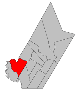 Location within York County, New Brunswick. | |
| Coordinates: 45.845°N 67.535°W | |
| Country | |
| Province | |
| County | York |
| Established | 1855 |
| Area | |
| • Land | 556.15 km2 (214.73 sq mi) |
| Population (2016)[1] | |
| • Total | 525 |
| • Density | 0.9/km2 (2/sq mi) |
| • Change 2011-2016 | |
| • Dwellings | 456 |
| Time zone | UTC-4 (AST) |
| • Summer (DST) | UTC-3 (ADT) |
For governance purposes it is divided between the villages of Canterbury and Meductic and the local service districts of Benton and the parish of Canterbury.[3]
Delineation
Canterbury Parish is defined in the Territorial Division Act[2] as being bounded:
- Southeast by Dumfries and McAdam Parishes; northeasterly and northerly by the Saint John River and Eel River; west by Eel River, where Bull Creek enters the same; thence up Eel River through the first, second and third lakes to the head of the last mentioned lake; thence in a direct line southeasterly to the head of the La Coote Lake; thence through said lake and down La Coote Stream and the main Palfrey Stream to the McAdam Parish line including Fall Island[lower-alpha 2] in the Saint John River.
Communities
Parish population total does not include incorporated municipalities (in bold):
|
|
Demographics
Population
|
LanguageMother tongue (2016)[1]
|
gollark: JS-the-language has no threads specified, yes.
gollark: Well, yes, web workers and now Node.js worker threads, so how's JS threadless?
gollark: Node.js and the browser *both* have threads.
gollark: Ah yes.
gollark: What threadless language are you talking about?
See also
Notes
- Civil parishes served a variety of government functions until 1966, when the new Municipalities Act stripped them of their responsibilities; they continue to provide convenient boundaries for government uses, especially electoral districts and local service districts. Statistics Canada uses civil parishes as census subdivisions for all parts of the province that are not within municipalities and similar entities.
- Fall Island was submerged when Mactaquac Dam was built.
References
- "Census Profile, 2016 Census: Canterbury, Parish [Census subdivision], New Brunswick". Statistics Canada. Retrieved October 7, 2019.
- "Chapter T-3 Territorial Division Act". Government of New Brunswick. Retrieved 25 July 2020.
- "New Brunswick Regulation 84-168 under the Municipalities Act (O.C. 84-582)". Government of New Brunswick. Retrieved 25 July 2020.
- Statistics Canada: 1996, 2001, 2006 census
- 2006 Statistics Canada Community Profile: Canterbury Parish, New Brunswick
- 2011 Statistics Canada Census Profile: Canterbury Parish, New Brunswick
Places adjacent to Canterbury Parish, New Brunswick | |
|---|---|
| Subdivisions |
|
|---|---|
| Cities | |
| Counties | |
| |
This article is issued from Wikipedia. The text is licensed under Creative Commons - Attribution - Sharealike. Additional terms may apply for the media files.