Drowning Creek, Oklahoma
Drowning Creek is an unincorporated community and census-designated place (CDP) in Delaware County, Oklahoma, United States. The population was 155 at the 2010 census.[1]
Drowning Creek, Oklahoma | |
|---|---|
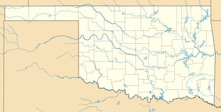 Drowning Creek Location in Oklahoma | |
| Coordinates: 36°28′29″N 94°51′59″W | |
| Country | United States |
| State | Oklahoma |
| County | Delaware |
| Area | |
| • Total | 0.89 sq mi (2.30 km2) |
| • Land | 0.89 sq mi (2.30 km2) |
| • Water | 0.0 sq mi (0.0 km2) |
| Elevation | 756 ft (230 m) |
| Population (2010) | |
| • Total | 155 |
| • Density | 175/sq mi (67.4/km2) |
| Time zone | UTC-6 (Central (CST)) |
| • Summer (DST) | UTC-5 (CDT) |
| FIPS code | 40-21676[1] |
| GNIS feature ID | 2584378[2] |
Geography
Drowning Creek is located northwest of the center of Delaware County, at the eastern end of an arm of the Grand Lake o' the Cherokees, in the valley of Drowning Creek. It is 6 miles (10 km) northwest of Jay, the county seat.
According to the United States Census Bureau, the Drowning Creek CDP has a total area of 0.89 square miles (2.3 km2), all of it land.[1]
gollark: +>markov
gollark: internet connectivity issues
gollark: oh bees
gollark: ph bees
gollark: +>markov
References
- "Geographic Identifiers: 2010 Demographic Profile Data (G001): Drowning Creek CDP, Oklahoma". U.S. Census Bureau, American Factfinder. Archived from the original on February 13, 2020. Retrieved December 9, 2015.
- U.S. Geological Survey Geographic Names Information System: Drowning Creek, Oklahoma
Municipalities and communities of Delaware County, Oklahoma, United States | ||
|---|---|---|
| Cities | 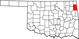 Delaware County map | |
| Towns | ||
| CDPs | ||
| Other unincorporated communities | ||
| Indian reservation | ||
| Footnotes | ‡This populated place also has portions in an adjacent county or counties | |
This article is issued from Wikipedia. The text is licensed under Creative Commons - Attribution - Sharealike. Additional terms may apply for the media files.