Dowling County
Dowling County is one of the 141 Cadastral divisions of New South Wales.
| Dowling New South Wales | |||||||||||||||
|---|---|---|---|---|---|---|---|---|---|---|---|---|---|---|---|
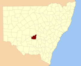 Location in New South Wales | |||||||||||||||
| |||||||||||||||
Dowling County was named in honour of Judge Sir James Dowling (1787-1844).[1]
Parishes within this county
A full list of parishes found within this county; their current LGA and mapping coordinates to the approximate centre of each location is as follows:
| Parish | LGA | Coordinates |
|---|---|---|
| Bimbalingel | Lachlan Shire Council | 33°18′54″S 146°12′04″E |
| Bimbil | Bland Shire Council | 33°37′54″S 146°08′04″E |
| Blairgowrie | Bland Shire Council | 33°37′54″S 146°35′04″E |
| Bootoowa | Lachlan Shire Council | 33°24′54″S 146°11′04″E |
| Borapine | Lachlan Shire Council | 33°18′54″S 146°43′04″E |
| Brewer | Lachlan Shire Council | 33°25′54″S 146°05′04″E |
| Brotheroney | Lachlan Shire Council | 33°10′54″S 146°44′04″E |
| Cargelligo | Lachlan Shire Council | 33°22′54″S 146°23′04″E |
| Carilla | Carrathool Shire Council | 33°24′54″S 145°55′04″E |
| Carisbrook | Lachlan Shire Council | 33°28′54″S 146°05′04″E |
| Clowery | Bland Shire Council | 33°42′54″S 146°40′04″E |
| Contarlo | Lachlan Shire Council | 33°28′54″S 146°10′04″E |
| Currawong | Bland Shire Council | 33°34′54″S 146°22′04″E |
| Curriba | Lachlan Shire Council | 33°27′54″S 146°41′04″E |
| Currikabakh | Bland Shire Council | 33°43′54″S 146°30′04″E |
| Davis | Bland Shire Council | 33°43′54″S 146°07′04″E |
| Dowling | Carrathool Shire Council | 33°32′54″S 146°03′04″E |
| Gainbill | Lachlan Shire Council | 33°23′54″S 146°31′04″E |
| Garryowen | Lachlan Shire Council | 33°28′54″S 146°19′04″E |
| Geelooma | Bland Shire Council | 33°36′54″S 146°40′04″E |
| Guagong | Lachlan Shire Council | 33°09′54″S 146°37′04″E |
| Gumbagunda | Lachlan Shire Council | 33°08′54″S 146°29′04″E |
| Gurangully | Lachlan Shire Council | 33°13′54″S 146°24′04″E |
| Jimberoo | Bland Shire Council | 33°43′54″S 146°13′04″E |
| Kikoira | Bland Shire Council | 33°39′54″S 146°40′04″E |
| Killawarra | Lachlan Shire Council | 33°26′54″S 146°30′04″E |
| Lachlan | Lachlan Shire Council | 33°11′54″S 146°20′04″E |
| Merri Merrigal | Carrathool Shire Council | 33°25′54″S 146°00′04″E |
| Mologone | Bland Shire Council | 33°37′54″S 146°15′04″E |
| Moneybung | Carrathool Shire Council | 33°29′54″S 146°00′04″E |
| Murrabung | Bland Shire Council | 33°44′54″S 146°24′04″E |
| Naradhan | Bland Shire Council | 33°43′54″S 146°18′04″E |
| Narden | Lachlan Shire Council | 33°22′54″S 146°42′04″E |
| Narriah | Bland Shire Council | 33°43′54″S 146°34′04″E |
| Regent | Lachlan Shire Council | 33°26′54″S 146°17′04″E |
| Rutland | Bland Shire Council | 33°37′54″S 146°31′04″E |
| Tibeaudo | Lachlan Shire Council | 33°24′54″S 146°33′04″E |
| Tooronga | Lachlan Shire Council | 33°22′54″S 146°17′04″E |
| Townsend | Carrathool Shire Council | 33°33′54″S 145°59′04″E |
| Trigalong | Lachlan Shire Council | 33°11′54″S 146°28′04″E |
| Tuggerabach | Lachlan Shire Council | 33°28′54″S 146°33′04″E |
| Uabba | Lachlan Shire Council | 33°19′54″S 146°07′04″E |
| Ulambong | Lachlan Shire Council | 33°13′54″S 146°11′04″E |
| Valencia | Carrathool Shire Council | 33°39′54″S 145°58′04″E |
| Wardry | Lachlan Shire Council | 33°04′54″S 146°45′04″E |
| Whoyeo | Lachlan Shire Council | 33°18′54″S 146°18′04″E |
| Whyaddra | Lachlan Shire Council | 33°03′54″S 146°38′04″E |
| Womboyn | Bland Shire Council | 33°40′54″S 146°20′04″E |
| Yarrabundry | Lachlan Shire Council | 33°17′54″S 146°36′04″E |
| Yarran | Lachlan Shire Council | 33°18′54″S 146°31′04″E |
| Yelkin | Lachlan Shire Council | 33°27′54″S 146°22′04″E |
gollark: Yes.
gollark: Running a chocolate factory!
gollark: It is mine. I happened to be breeding horribly messy ones.
gollark: https://dragcave.net/lineage/mpWNu Like this, which seems decent to me.
gollark: <@!334693227485462530> I can breed a less horrible one next week.
References
- "Dowling". Geographical Names Register (GNR) of NSW. Geographical Names Board of New South Wales. Retrieved 4 August 2013.

This article is issued from Wikipedia. The text is licensed under Creative Commons - Attribution - Sharealike. Additional terms may apply for the media files.