Dong'an District
Dong'an District (simplified Chinese: 东安区; traditional Chinese: 東安區; pinyin: Dōng'ān Qū; lit.: 'east peace') is a district of the city of Mudanjiang, Heilongjiang province, People's Republic of China.
Dong'an District 东安区 | |
|---|---|
District | |
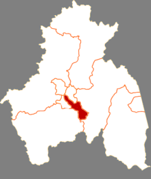 Location of Dongan District in Mudanjiang | |
.png) Mudanjiang in Heilongjiang | |
| Coordinates: 44°34′53″N 129°37′36″E | |
| Country | People's Republic of China |
| Province | Heilongjiang |
| Prefecture-level city | Mudanjiang |
| Township-level divisions | 5 subdistricts |
| District seat | No.123, East Chang'an Street (东长安街123号) |
| Area | |
| • Total | 294.2 km2 (113.6 sq mi) |
| Elevation | 235 m (771 ft) |
| Population (2017) | |
| • Total | 220,000 |
| • Density | 750/km2 (1,900/sq mi) |
| Time zone | UTC+8 (China Standard) |
| Website | www |
Administrative divisions
There are five subdistricts in the district:[1]
The four subdistricts and one town are:
- Qixing Subdistrict (七星街道), Xin'an Subdistrict (新安街道), Chang'an Subdistrict (长安街道), Wuxing Subdistrict (五星街道), Xinglong Town (兴隆镇)
Notes and references
- 2011年统计用区划代码和城乡划分代码:东安区 (in Chinese). National Bureau of Statistics of the People's Republic of China. Retrieved 2013-02-05.
gollark: You are meant to have code around the `unsafe` bit to check invariants.
gollark: (outside `unsafe` blocks)
gollark: Raw pointers == banned.
gollark: You can't except in `unsafe`.
gollark: It checks borrows.
This article is issued from Wikipedia. The text is licensed under Creative Commons - Attribution - Sharealike. Additional terms may apply for the media files.