Dombóvár District
Dombóvár (Hungarian: Dombóvári járás) is a district in south-western part of Tolna County. Dombóvár is also the name of the town where the district seat is found. The district is located in the Southern Transdanubia Statistical Region.
Dombóvár District Dombóvári járás | |
|---|---|
 Coat of arms | |
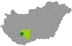 Dombóvár District within Hungary and Tolna County. | |
| Country | |
| County | Tolna |
| District seat | Dombóvár |
| Area | |
| • Total | 509.02 km2 (196.53 sq mi) |
| Area rank | 4th in Tolna |
| Population (2011 census) | |
| • Total | 32,331 |
| • Rank | 4th in Tolna |
| • Density | 64/km2 (170/sq mi) |
Geography
Dombóvár District borders with Tamási District to the north and east, Hegyhát District (Baranya County) to the south, Kaposvár District and Tab District (Somogy County) to the west. The number of the inhabited places in Dombóvár District is 16.
Municipalities
The district has 1 town and 15 villages. (ordered by population, as of 1 January 2013)[1]
The bolded municipality is city.
gollark: And you can automate all the install stuff with a script.
gollark: (GNU/)Linux is much more convenient that way, since there are *no* product keys.
gollark: NixOS is also cool.
gollark: ...
gollark: Why pastebin run?
See also
- List of cities and towns in Hungary
References
- "A KSH 2013. évi helységnévkönyve". ksh.hu. Retrieved 2017-12-26.
This article is issued from Wikipedia. The text is licensed under Creative Commons - Attribution - Sharealike. Additional terms may apply for the media files.