Dolný Badín
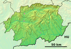
Dolný Badín (Hungarian: Alsóbágyon, earlier Alsóbadin) is a village and municipality in the Krupina District of the Banská Bystrica Region of Slovakia.
Dolný Badín | |
|---|---|
Municipality | |
 Dolný Badín Location of Dolný Badín in the Banská Bystrica Region  Dolný Badín Location of Dolný Badín in Slovakia | |
| Coordinates: 48°16′N 19°04′E | |
| Country | |
| Region | Banská Bystrica |
| District | Krupina |
| First mentioned | 1135 |
| Area | |
| • Total | 6.24 km2 (2.41 sq mi) |
| Elevation | 305 m (1,001 ft) |
| Time zone | UTC+1 (CET) |
| • Summer (DST) | UTC+2 (CEST) |
| Postal code | 962 51 (pošta Čabradský Vrbovok) |
| Area code(s) | 421-45 |
| Car plate | KA |
| Website | www.dolnybadin.sk |
History
The area of the village has been continuously inhabited by various peoples since the Neolithic period. In historical records, the village was first mentioned in 1135 (1135 Badin, Badun, 1391 Bagyon) when it belonged to Bzovík Castle.
Genealogical resources
The records for genealogical research are available at the state archive "Statny Archiv in Banska Bystrica, Slovakia"
- Roman Catholic church records (births/marriages/deaths): 1800-1895 (parish A)
- Lutheran church records (births/marriages/deaths): 1786-1895 (parish B)
gollark: Anyway, consider queueing a table containing functions instead.
gollark: I mean, it is at least possible to have events containing functions.
gollark: Er, you can.
gollark: You don't actually need the `open` or `connect`.
gollark: `wget https://raw.githubusercontent.com/osmarks/skynet/master/client.lua skynet`
External links

- Official website

- https://www.webcitation.org/5QjNYnAux?url=http://www.statistics.sk/mosmis/eng/run.html.
- http://www.e-obce.sk/obec/dolnybadin/dolny-badin.html
- Surnames of living people in Dolny Badin
This article is issued from Wikipedia. The text is licensed under Creative Commons - Attribution - Sharealike. Additional terms may apply for the media files.