Dogwood, Indiana
Dogwood is an unincorporated community in Webster Township, Harrison County, Indiana.
Dogwood, Indiana | |
|---|---|
 | |
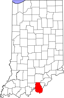
 Harrison County's location in Indiana | |
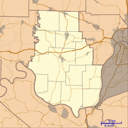
 Dogwood Dogwood's location in Harrison County | |
| Coordinates: 38°06′19″N 86°05′04″W | |
| Country | United States |
| State | Indiana |
| County | Harrison |
| Township | Webster |
| Elevation | 676 ft (206 m) |
| ZIP code | 47135 |
| FIPS code | 18-18316[1] |
| GNIS feature ID | 433609[2] |
History
A post office was established at Dogwood in 1890, and remained in operation until it was discontinued in 1922.[3] The community was likely named after the dogwood tree.[4]
Geography
Dogwood is located at 38°06′19″N 86°05′04″W.
gollark: I only write for my own systems and whoever is unfortunate enough to try and clone my poorly documented repos so I can use whatever.
gollark: I also don't see why you need a 10D array over just a long 1D one.
gollark: It's probably going to be worse than AES and actual standards like that.
gollark: Please do *not* invent your own cryptography for any serious purposes.
gollark: Anyway, you could just write code for doing so for a 1D array, and then code for filling 10 N-1-dimensional arrays and merging them into a N-dimensional array
References
- "U.S. Census website". United States Census Bureau. Retrieved 2008-01-31.
- "Dogwood, Indiana". Geographic Names Information System. United States Geological Survey. Retrieved 2009-10-10.
- "Harrison County". Jim Forte Postal History. Archived from the original on 24 September 2014. Retrieved 17 September 2014.
- Baker, Ronald L. (October 1995). From Needmore to Prosperity: Hoosier Place Names in Folklore and History. Indiana University Press. p. 115. ISBN 978-0-253-32866-3.
Apparently the name is for the tree.
This article is issued from Wikipedia. The text is licensed under Creative Commons - Attribution - Sharealike. Additional terms may apply for the media files.