Dobrava pod Rako
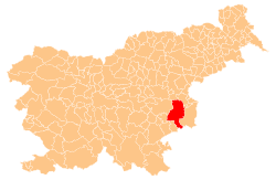
Dobrava pod Rako (pronounced [dɔˈbɾaːʋa pɔd ˈɾaːkɔ]) is a small settlement to the south of Raka in the Municipality of Krško in eastern Slovenia. The area was traditionally part of Lower Carniola. It is now included in the Lower Sava Statistical Region.[2]
Dobrava pod Rako | |
|---|---|
 Dobrava pod Rako Location in Slovenia | |
| Coordinates: 45°54′43.6″N 15°22′14.12″E | |
| Country | |
| Traditional region | Lower Carniola |
| Statistical region | Lower Sava |
| Municipality | Krško |
| Area | |
| • Total | 0.2 km2 (0.08 sq mi) |
| Elevation | 163.7 m (537.1 ft) |
| Population (2002) | |
| • Total | 19 |
| [1] | |
Name
The name of the settlement was changed from Dobrava to Dobrava pod Rako in 1953.[3]
gollark: Haskell is interesting because it's very different to the vaguely imperative/OOP languages you've used.
gollark: <@!426660245738356738> Haskell
gollark: Start with a small random house/road thing, and then randomly add extra bits on?
gollark: In America you might find just grid layouts, which are easier, but here in the UK cities grew from tiny villages in an unplanned way.
gollark: Because lots of cities grew naturally.
References
- Statistical Office of the Republic of Slovenia
- Krško municipal site
- Spremembe naselij 1948–95. 1996. Database. Ljubljana: Geografski inštitut ZRC SAZU, DZS.
External links
This article is issued from Wikipedia. The text is licensed under Creative Commons - Attribution - Sharealike. Additional terms may apply for the media files.