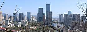
Dinghai District
![]()
Dinghai 定海区 Tinghai | |
|---|---|
District | |
 Zhoushan New Town | |
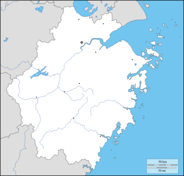
 Dinghai Location in Zhejiang | |
| Coordinates (Dinghai District government): 30°01′11″N 122°06′24″E | |
| Country | People's Republic of China |
| Province | Zhejiang |
| Prefecture-level city | Zhoushan |
| Seat | Changguo Subdistrict |
| Area | |
| • Total | 1,444.0 km2 (557.5 sq mi) |
| • Land | 568.8 km2 (219.6 sq mi) |
| • Water | 875.2 km2 (337.9 sq mi) |
| Population (2019) | |
| • Total | 399,382 |
| • Density | 280/km2 (720/sq mi) |
| Time zone | UTC+8 (China Standard) |
| Postal code | 316000 |
| Website | dinghai |
| Dinghai (the former county) | |||||||||
|---|---|---|---|---|---|---|---|---|---|
| Chinese | 定海 | ||||||||
| Postal | Tinghai | ||||||||
| |||||||||
The district, which was formed in January 1987 when it was upgraded from county status, has a population of 399,382 as of 2019.[1][2]
History
According to the Dinghai People's Government, the area of Dinghai has been inhabited by humans for over 5,000 years.[2]
During the Spring and Autumn period, the area was known as Yongdong (甬东; 甬東), and belonged to the Yue state.[2]
The area was incorporated as Wenshan County (翁山县; 翁山縣) in 738 CE.[2] In 771 CE, the county was abolished and placed under Mao County (鄮县; 鄮縣).[2]
In 1073, the area was organized as Changguo County (昌国县; 昌國縣), and was placed under the jurisdiction of the Ming Prefecture.[2]
Dinghai County (定海县; 定海縣) was first established in 1688, under the Qing Dynasty.[2]
During the First Opium War, Dinghai was taken by British forces on July 6, 1840.[3] Dinghai was handed back by Charles Elliot, but was subsequently re-captured by Henry Pottinger, on October 1, 1841.[3]
Dinghai was taken by the People's Liberation Army on May 17, 1950.[2]
In October 1958, Zhoushan's prefecture-level status was revoked, and the area became part of Zhoushan County.[2] In April 1962, Zhoushan was restored to prefecture-level status, and Dinghai County was re-established.[2]
In January 1987, Dinghai County became Dinghai District (定海区).[2]
Geography

Dinghai District has a total area of 1,444.0 square kilometres, of which, 568.8 square kilometres is land, and the remaining 875.2 square kilometres is sea.[4]
The district spans 128 islands, including Zhoushan Island, Jintang Island, Damao Island (大猫岛), Cezi Island, Changbai Island, and Aoshan Island.[5] Other islands include Changzhi Island (长峙岛) and Panzhi Island (盘峙岛).[4] Many of the islands have hilly terrain, and the highest point in the district is Huangyanjian Mountain (黄杨尖山), which reaches 503.6 meters in altitude.[5]
The area is rich in marine life, with 80 species of fish, and over 150 species of shellfish.[5] The endangered black-faced spoonbill, the yellow-billed egret, the horned grebe, and other species of birds are also native to the island.[5]
Climate
The district experiences an average temperature of 16.8 °C.[5] The district's coldest month is January, which averages 6.2 °C in temperature, and the district's warmest month is August, which averages 27.4 °C in temperature.[5] The coldest temperature recorded in the district was −4.2 °C, which occurred on December 28, 1991.[5] The warmest temperature recorded in the district was 40.2 °C, which occurred on July 21, 2007.[5]
Average annual rainfall in Dinghai is 1410.8 millimetres, and the district experiences an average of 149 rainy days per year.[5]
The area experiences typhoons, heavy rains, floods, and droughts.[5] The district was hit by a blizzard on March 12, 2005, which bought the most snowfall to the area since 1978.[5]
Administrative divisions

Dinghai District administers consisted of 10 subdistricts and 3 towns.[1][6] As of 2019, these township-level divisions were further divided into 41 residential communities, 73 rural villages, and 7 urban villages.[7]
| English Name | Subdivision Type | Chinese Name | Population (2019) |
|---|---|---|---|
| Changguo Subdistrict | Subdistrict | 昌国街道; Chāngguó Jiēdào | 54,457 |
| Huannan Subdistrict | Subdistrict | 环南街道; Huánnán Jiēdào | 34,874 |
| Chengdong Subdistrict | Subdistrict | 城东街道; Chéngdōng Jiēdào | 51,578 |
| Yancang Subdistrict | Subdistrict | 盐仓街道; Yáncāng Jiēdào | 19,600 |
| Lincheng Subdistrict | Subdistrict | 临城街道; Línchéng Jiēdào | 46,886 |
| Cengang Subdistrict | Subdistrict | 岑港街道; Céngǎng Jiēdào | 18,063 |
| Ma'ao Subdistrict | Subdistrict | 马岙街道; Mǎ'ào Jiēdào | 9,653 |
| Shuangqiao Subdistrict | Subdistrict | 双桥街道; Shuāngqiáo Jiēdào | 18,170 |
| Xiaosha Subdistrict | Subdistrict | 小沙街道; Xiǎoshā Jiēdào | 19,802 |
| Qiandao Subdistrict | Subdistrict | 千岛街道; Qiāndǎo Jiēdào | 39,189 |
| Jintang | Town | 金塘镇; Jīntáng Zhèn | 40,074 |
| Baiquan | Town | 白泉镇; Báiquán Zhèn | 37,144 |
| Ganlan | Town | 干𬒗镇; Gànlán Zhèn | 9,892 |
Historic divisions
In July 1994, the district had 4 subdistricts, 7 towns, and 14 townships.[8] The district's 4 subdistricts were Changguo Subdistrict, Huannan Subdistrict, Chengdong Subdistrict, and the now-defunct Jiefang Subdistrict.[8] The district's 7 towns were Xiaosha (now a subdistrict), Cengang (now a subdistrict), Lincheng (now a subdistrict), Baiquan, Ganlan, the now-defunct Dafeng (大丰镇), and the now-defunct Ligang (沥港镇).[8] The district's 14 townships were Ma'ao Township (now a subdistrict), Shantan Township (山潭乡), Changbai Township (长白乡), Dasha Township (大沙乡), Yandun Township (烟墩乡), Mamu Township (马目乡), Cezi Township (册子乡), Shijiao Township (石礁乡), Yancang Township (now a subdistrict), Ziwei Township (紫微乡), Changzhi Township (长峙乡), Beichan Township (北蝉乡), Panzhi Township (盘峙乡), and Damao Township (大猫乡).[8]
By 2000, Ma'ao was promoted from a township to a town.[8]
In September 2004, Lincheng was promoted from a town to a subdistrict.[7]
In May 2008, the town of Jintang was set up.[7]
In 2017, Qiandao Subdistrict split off from Lincheng Subdistrict.[7]
Demographics
As of 2019, Dinghai District has a population of 399,382 people, an increase of 1,813 (0.456%) from 2018.[1] The district has 96.58 males per 100 females.[1]
In the 2000 Chinese Census, the district had a population of 369,448.[8]
Economy
The district had a GDP of ¥31 billion as of 2011.[9]
References
- 人口状况 [Population Situation] (in Chinese). Dinghai People's Government. 2020-03-04. Archived from the original on 2020-08-13. Retrieved 2020-08-13.
- 历史沿革 [History] (in Chinese). Dinghai People's Government. 2018-05-11. Archived from the original on 2020-08-13. Retrieved 2020-08-13.
- Dillon, Michael (2012). China: A modern history (New paperback ed.). London. pp. 52, 57. ISBN 978-1-78076-381-1. OCLC 793689711.
- 定海区概况地图. xzqh.org (in Chinese). 2013-11-14. Archived from the original on 2020-08-13. Retrieved 2020-08-13.
- 自然地理 [Physical Geography] (in Chinese). Dinghai District People's Government. 2015-12-04. Archived from the original on 2020-08-13. Retrieved 2020-08-13.
- 2019年统计用区划代码 (in Chinese). National Bureau of Statistics of China. 2019. Archived from the original on 2020-08-13. Retrieved 2020-08-13.
- 行政区划 [Administrative Divisions] (in Chinese). Dinghai People's Government. 2020-04-27. Archived from the original on 2020-08-13. Retrieved 2020-08-13.
- 定海区历史沿革. xzqh.org (in Chinese). 2013-11-14. Archived from the original on 2020-08-13. Retrieved 2020-08-13.
- http://www.zhoushan.gov.cn/html/233415.html%5B%5D
External links
- Official site (in Chinese)