Dial, Kansas
Dial was a small settlement in Covert Township, Osborne County, Kansas, United States.
Dial, Kansas | |
|---|---|
| Coordinates: 39°13′55″N 98°46′31″W [1] | |
| Country | United States |
| State | Kansas |
| County | Osborne |
| Elevation | 1,886 ft (575 m) |
| Time zone | UTC-6 (Central (CST)) |
| • Summer (DST) | UTC-5 (CDT) |


History
Dial was located in the Covert Creek Valley in Osborne County.[2] Dial was issued a post office in 1881. The post office was discontinued in 1903.[3] There is nothing left of Dial.
gollark: I DEFINITELY didn't do that whatsoever.
gollark: Is it? Oops.
gollark: (SHA-384)
gollark: Did you know? The hash of my entry is 8a15cdbc0c99c9796bd5ce7ba8a9f9bf1616bf7dc2fa4b8ade4ed4e5baec57eac6eecacd0d9697204004a46395e2139e.
gollark: I precommitted to it, see.
References
- "Topo Map". TopoZone. Retrieved 2017-12-30.
- Blackmar, Frank Wilson (1912). Kansas: A Cyclopedia of State History, Volume 1. Chicago: Standard Publishing Company. p. 517.
- "Kansas Post Offices, 1828-1961". Kansas Historical Society. Retrieved 2017-12-30.
Municipalities and communities of Osborne County, Kansas, United States | ||
|---|---|---|
| Cities | 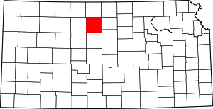 Map of Kansas highlighting Osborne County | |
| Unincorporated communities | ||
| Ghost towns | ||
| Townships |
| |
This article is issued from Wikipedia. The text is licensed under Creative Commons - Attribution - Sharealike. Additional terms may apply for the media files.