Dhauladhar
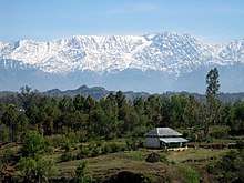
The Dhauladhar range (lit. The White Range)[1] is part of a lesser Himalayan chain of mountains. It rises from the Indian plains to the north of Kangra and Mandi. Dharamsala, the headquarters of Kangra district, lies on its southern spur in above the Kangra Valley, which divides it from Chamba.[2]
Overview
The highest peak in the range is the Hanuman Tibba, approached from Beas Kund/Manali, about 5982m high. There are several peaks which are close to 5,180 m (17,000 ft).
Himachal Pradesh has all the major Himalayan ranges represented in it. The Greater Himalayas that begin from near Ladakh and run all the way to Mount Everest and Kangchenjunga in Sikkim, pass through Himachal Pradesh.
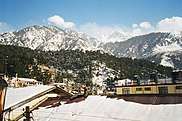
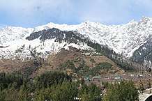
The Pir Panjal Range starting from near Patni Top in Jammu and Kashmir all the way to Garhwal passes through Himachal Pradesh. Finally, there is the Dhauladhar range, also known as the Outer Himalayas or Lesser Himalayas. They begin from near Dalhousie at the northwest end of Himachal Pradesh and pass through the state to the vicinity of the bank of the Beas River in the Kulu district of Himachal Pradesh. While they end near Badrinath in Garhwal, they lie almost entirely in Himachal Pradesh. They are distinctive in their typical dark granite rocky formations with a remarkably steep rise culminating in sharp streaks of snow and ice at the top of their crested peaks. This distinctive profile is best seen from the Kangra Valley from where they seem to shoot up almost vertically.
The elevation of the Dhauladhars ranges widely from 3,500 m to nearly 6,000 m. From the banks of the Beas river in Kulu, the range curves towards the town of Mandi, Himachal Pradesh, India. Then, running north, it passes through Barabhangal, joins the Pir Panjal range and moves into Chamba, Himachal Pradesh.
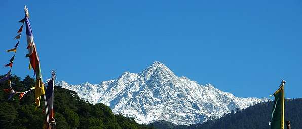
The Dhauladhars have a peculiar topography. Although mostly composed of granite, the flanks of the range exhibit frequent formations of slate (often used for the roofs of houses in the region), limestone and sandstone. Ascending from any side is a difficult, given the near vertical incline. This calls for highly technical trekking and mountaineering. There is very little habitation on the range given the harsh conditions. But meadows abound near the crest providing rich pastures for grazing where large numbers of Gaddi shepherds take their flocks. The top of the crest is buried under vast expanses of thick snow. Triund - Ilaqua Ghot (इलाका घोट), approached from the hill station of McLeod Ganj, is the nearest and most accessible snow line in the Indian Himalayas. The range has rich flora and fauna.
Peaks, virgin and scaled, have drawn mountaineers from all over the world. Some of the well-known ones are Mun (4610 m) near Dharamshala, Manimahesh Kailash (मणिमहेश कैलाश) (5653 m) in the sacred Manimahesh region, Gaurjunda (4946 m), near the Talang pass, which is commonly referred to as the 'Dhauladhar Matterhorn', Christmas (4581 m), Toral (4686 m), Dromedary (4553 m), Riflehorn (4400 m), Lantern (5100 m), Arthur's Seat (4525 m), Camel (4520 m), Slab (4570 m), and several other named and unnamed peaks.
Due to the position of the range it receives two monsoons a year with heavy rains; where the mountains have not been heavily logged, there are dense pine and Deodar forests.
There are glacial lakes in the Dhauladhars. Prominent among them is the Lam Dal which is the biggest with a circumference of about 2.5 km. It is a very sacred lake and considered to be the abode of Lord Shiva. Each year pilgrims take a holy dip in August and September just when the Manimahesh yatra begins. There are other very sacred lakes like the Nag Dal/Nag Chattri Dal. This lake owes its history to the Bhagsunag Temple and is considered sacred. It is dedicated to the Nag Devta or the Lord King Cobra. The other beautiful lakes are the Chanderkup Dal above the Lam Dal, Kareri Dal below the Minkaini Pass, Dansar Lake across the Sari Pass and the very sacred Kali Kund just 150 m below the Lam Dal at an elevation of 3900 m and approachable from Minkiani Pass (4250 metres).
One of the major passes across this range is the Indrahar Pass. At an altitude of 4,342 metres (14,245 ft) above mean sea level, near the tourist town of Dharamshala in Himachal Pradesh, Indrahar Pass forms the border between Kangra and Chamba districts. It is part of a popular trekking route from Dharamshala. It attracts substantial tourist traffic during the trekking season between April and October.
The Dhauladhar mountain range became visible after 30 years in Jalandhar, Punjab, less than 200 kms away, after pollution levels came down amidst the Coronavirus lockdown in March 2020. The straight line distance to this mountain range from Jalandhar is only 120-140 kms. And if you use the distance to horizon formula from here Horizon then at 200 kms distance you can see a 3150 m peak. Here it says the range is 3500 m to 6000 m and so you can easily see it in clear days from Jalandhar (elevation: 228 m).
Gallery
.jpg)

See also
Footnotes
- Singh (2000), p. 2.
- Dhaula Dhar The Imperial Gazetteer of India, v. 11, p. 287.
References
- Singh, Mian Goverdhan (2000). Himachal Pradesh: History, Culture & Economy. 5th Edition. Extensively revised by C.L. Gupta & Kulbhushan Chandel. Minerva Publishers & Distributors, Shimla.
External links
| Wikimedia Commons has media related to Dhauladhar. |