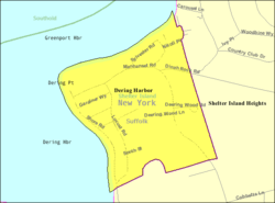
Dering Harbor, New York
Dering Harbor is a village in the Town of Shelter Island, Suffolk County, New York, in the U.S. It is located on the north side of the island of Shelter Island, east of the hamlet of Shelter Island Heights. As of the 2010 census, the village population was 11, making it the least populated village in the State of New York.
Dering Harbor, New York | |
|---|---|
Village | |
| Village of Dering Harbor | |
 | |
 Dering Harbor, New York | |
| Coordinates: 41°5′35″N 72°20′43″W | |
| Country | United States |
| State | New York |
| County | Suffolk |
| Government | |
| • Mayor | John T. Colby Jr. |
| Area | |
| • Total | 0.26 sq mi (0.67 km2) |
| • Land | 0.25 sq mi (0.64 km2) |
| • Water | 0.01 sq mi (0.03 km2) |
| Elevation | 7 ft (2 m) |
| Population (2010) | |
| • Total | 11 |
| • Estimate (2019)[2] | 11 |
| • Density | 44.72/sq mi (17.29/km2) |
| Time zone | UTC-5 (Eastern (EST)) |
| • Summer (DST) | UTC-4 (EDT) |
| FIPS code | 36-20379 |
| GNIS feature ID | 0948345 |
| Website | https://deringharborvillage.org |
Geography
Dering Harbor is located at 41° 5' 35" North, 72° 20' 43" West (41.093155, -72.345242).[3] According to the United States Census Bureau, the village has a total area of 0.2 square miles (0.52 km2), of which, 0.2 square miles (0.52 km2) of it is land and 4.00% is water.
Demographics
| Historical population | |||
|---|---|---|---|
| Census | Pop. | %± | |
| 1920 | 3 | — | |
| 1930 | 39 | 1,200.0% | |
| 1940 | 34 | −12.8% | |
| 1950 | 4 | −88.2% | |
| 1960 | 19 | 375.0% | |
| 1970 | 24 | 26.3% | |
| 1980 | 16 | −33.3% | |
| 1990 | 28 | 75.0% | |
| 2000 | 13 | −53.6% | |
| 2010 | 11 | −15.4% | |
| Est. 2019 | 11 | [2] | 0.0% |
| U.S. Decennial Census[4] | |||
At the 2000 census there were 13 people, 6 households, and 3 families in the village. The population density was 54.1 people per square mile (20.9/km²). There were 32 housing units at an average density of 133.2 per square mile (51.5/km²). The racial makeup of the village was 92.31% White and 7.69% Native American.[5] Of the 6 households 16.7% had children under the age of 18 living with them, 50.0% were married couples living together, and 50.0% were non-families. 33.3% of households were one person and 16.7% were one person aged 65 or older. The average household size was 2.17 and the average family size was 3.00.
The age distribution was 15.4% under the age of 18, 23.1% from 18 to 24, 7.7% from 25 to 44, 30.8% from 45 to 64, and 23.1% 65 or older. The median age was 46 years. For every 100 females, there were 116.7 males. For every 100 females age 18 and over, there were 120.0 males.
The median household income was $33,750 and the median family income was $98,750. Males had a median income of $36,250 versus $0 for females. The per capita income for the village was $43,185. No one in the village was below the poverty line.
References
- "2019 U.S. Gazetteer Files". United States Census Bureau. Retrieved July 27, 2020.
- "Population and Housing Unit Estimates". United States Census Bureau. May 24, 2020. Retrieved May 27, 2020.
- "US Gazetteer files: 2010, 2000, and 1990". United States Census Bureau. 2011-02-12. Retrieved 2011-04-23.
- "Census of Population and Housing". Census.gov. Retrieved June 4, 2015.
- "U.S. Census website". United States Census Bureau. Retrieved 2008-01-31.