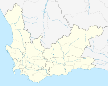
De Rust
De Rust is a small village at the gateway to the Klein Karoo, South Africa.
De Rust | |
|---|---|
De Rust Dutch Reformed Church | |
 De Rust  De Rust | |
| Coordinates: 33°28′S 22°31′E | |
| Country | South Africa |
| Province | Western Cape |
| District | Garden Route |
| Municipality | Oudtshoorn |
| Area | |
| • Total | 17.63 km2 (6.81 sq mi) |
| Population (2011)[1] | |
| • Total | 3,566 |
| • Density | 200/km2 (520/sq mi) |
| Racial makeup (2011) | |
| • Black African | 2.5% |
| • Coloured | 87.4% |
| • Indian/Asian | 0.5% |
| • White | 8.9% |
| • Other | 0.8% |
| First languages (2011) | |
| • Afrikaans | 93.6% |
| • English | 4.1% |
| • Other | 2.3% |
| Time zone | UTC+2 (SAST) |
| Postal code (street) | 6651 |
| PO box | 6650 |
| Area code | 044 |
Location
De Rust is located at the foot of the Swartberg Mountain range between Oudtshoorn and Beaufort West.
De Rust is also known for the meandering Meiringspoort pass. Meiringspoort is a gateway that connects the Klein Karoo (little Karoo) and the (great) Karoo through a gorge with a 25 km road crossing the same river 25 times in the span of the 25 km.[2][3]
Farming
This area is also well known for ostrich farming and most of the farmers in the area either farm exclusively with ostriches or as a sideline to their existing farming.
gollark: No.
gollark: It is very good at this.
gollark: Because I wanted a highly generic cheap watch.
gollark: Literally metaphorically the most generic possible watch.
gollark: At least mine has a cooler replacement strap.
References
- "Main Place De Rust". Census 2011.
- G. Ross: Romance of Cape Mountain Passes. New Africa Books. 2004. ISBN 0864866631, 9780864866639. p.89.
- Meiringspoort Pass
| Wikimedia Commons has media related to De Rust. |
This article is issued from Wikipedia. The text is licensed under Creative Commons - Attribution - Sharealike. Additional terms may apply for the media files.
.svg.png)