Dawson, North Dakota
Dawson is a city in Kidder County, North Dakota, United States. The population was 61 at the 2010 census.[5]
Dawson, North Dakota | |
|---|---|
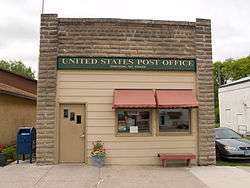 Post office in Dawson | |
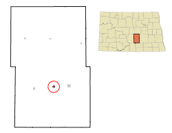 Location of Dawson, North Dakota | |
| Coordinates: 46°52′2″N 99°45′9″W | |
| Country | United States |
| State | North Dakota |
| County | Kidder |
| Area | |
| • Total | 0.34 sq mi (0.88 km2) |
| • Land | 0.34 sq mi (0.88 km2) |
| • Water | 0.00 sq mi (0.00 km2) |
| Elevation | 1,752 ft (534 m) |
| Population | |
| • Total | 61 |
| • Estimate (2019)[3] | 65 |
| • Density | 190.62/sq mi (73.67/km2) |
| Time zone | UTC-6 (Central (CST)) |
| • Summer (DST) | UTC-5 (CDT) |
| ZIP code | 58428 |
| Area code(s) | 701 |
| FIPS code | 38-18260 |
| GNIS feature ID | 1028621[4] |
History
Dawson was laid out in 1882 by J. Dawson Thompson, and named for him.[6] A post office has been in operation at Dawson since 1881.[7]
Geography
Dawson is located at 46°52′2″N 99°45′9″W (46.867102, -99.752439).[8]
According to the United States Census Bureau, the city has a total area of 0.34 square miles (0.88 km2), all of it land.[9]
Demographics
| Historical population | |||
|---|---|---|---|
| Census | Pop. | %± | |
| 1920 | 298 | — | |
| 1930 | 306 | 2.7% | |
| 1940 | 263 | −14.1% | |
| 1950 | 280 | 6.5% | |
| 1960 | 206 | −26.4% | |
| 1970 | 131 | −36.4% | |
| 1980 | 144 | 9.9% | |
| 1990 | 78 | −45.8% | |
| 2000 | 75 | −3.8% | |
| 2010 | 61 | −18.7% | |
| Est. 2019 | 65 | [3] | 6.6% |
| U.S. Decennial Census[10] 2018 Estimate[11] | |||
Dawson has a veteran's memorial wall to honor soldiers in foreign wars.
2010 census
As of the census[2] of 2010, there were 61 people, 30 households, and 16 families residing in the city. The population density was 179.4 inhabitants per square mile (69.3/km2). There were 54 housing units at an average density of 158.8 per square mile (61.3/km2). The racial makeup of the city was 100.0% White. Hispanic or Latino of any race were 8.2% of the population.
There were 30 households, of which 20.0% had children under the age of 18 living with them, 40.0% were married couples living together, 6.7% had a female householder with no husband present, 6.7% had a male householder with no wife present, and 46.7% were non-families. 46.7% of all households were made up of individuals, and 16.6% had someone living alone who was 65 years of age or older. The average household size was 2.03 and the average family size was 2.75.
The median age in the city was 52.5 years. 21.3% of residents were under the age of 18; 6.6% were between the ages of 18 and 24; 16.4% were from 25 to 44; 32.8% were from 45 to 64; and 23% were 65 years of age or older. The gender makeup of the city was 57.4% male and 42.6% female.
2000 census
As of the census of 2000, there were 75 people, 38 households, and 16 families residing in the city. The population density was 186.9 people per square mile (72.4/km2). There were 52 housing units at an average density of 129.6 per square mile (50.2/km2). The racial makeup of the city was 100.00% White.
There were 38 households, out of which 18.4% had children under the age of 18 living with them, 31.6% were married couples living together, 2.6% had a female householder with no husband present, and 55.3% were non-families. 52.6% of all households were made up of individuals, and 36.8% had someone living alone who was 65 years of age or older. The average household size was 1.97 and the average family size was 3.00.
In the city, the population was spread out, with 20.0% under the age of 18, 9.3% from 18 to 24, 14.7% from 25 to 44, 25.3% from 45 to 64, and 30.7% who were 65 years of age or older. The median age was 49 years. For every 100 females, there were 127.3 males. For every 100 females age 18 and over, there were 93.5 males.
The median income for a household in the city was $20,833, and the median income for a family was $22,917. Males had a median income of $23,750 versus $0 for females. The per capita income for the city was $13,192. There were no families and 20.3% of the population living below the poverty line, including no under eighteens and 23.3% of those over 64.
See also
- Harker Lake
- Upper Harker Lake
External links
References
- "2019 U.S. Gazetteer Files". United States Census Bureau. Retrieved July 27, 2020.
- "U.S. Census website". United States Census Bureau. Retrieved June 14, 2012.
- "Population and Housing Unit Estimates". United States Census Bureau. May 24, 2020. Retrieved May 27, 2020.
- "US Board on Geographic Names". United States Geological Survey. October 25, 2007. Retrieved January 31, 2008.
- "2010 Census Redistricting Data (Public Law 94-171) Summary File". American FactFinder. United States Census Bureau. Retrieved May 2, 2011.
- Agricultural Soil Survey of North Dakota. North Dakota Agricultural College Survey. 1910. p. 63.
- "Kidder County". Jim Forte Postal History. Retrieved October 22, 2015.
- "US Gazetteer files: 2010, 2000, and 1990". United States Census Bureau. February 12, 2011. Retrieved April 23, 2011.
- "US Gazetteer files 2010". United States Census Bureau. Archived from the original on January 25, 2012. Retrieved June 14, 2012.
- United States Census Bureau. "Census of Population and Housing". Retrieved October 30, 2013.
- "Population Estimates". United States Census Bureau. Retrieved August 3, 2019.
Municipalities and communities of Kidder County, North Dakota, United States | ||
|---|---|---|
| Cities | 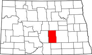 Map of North Dakota highlighting Kidder County | |
| Townships |
| |
| Unorganized territories |
| |
| Unincorporated communities | ||